Elaine Topo Map Arkansas
To zoom in, hover over the map of Elaine
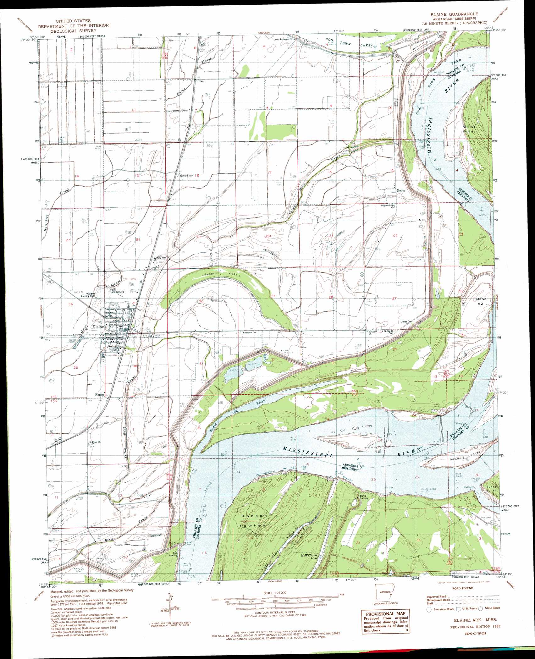
USGS Topo Quad 34090c7 - 1:24,000 scale
| Topo Map Name: | Elaine |
| USGS Topo Quad ID: | 34090c7 |
| Print Size: | ca. 21 1/4" wide x 27" high |
| Southeast Coordinates: | 34.25° N latitude / 90.75° W longitude |
| Map Center Coordinates: | 34.3125° N latitude / 90.8125° W longitude |
| U.S. States: | AR, MS |
| Filename: | o34090c7.jpg |
| Download Map JPG Image: | Elaine topo map 1:24,000 scale |
| Map Type: | Topographic |
| Topo Series: | 7.5´ |
| Map Scale: | 1:24,000 |
| Source of Map Images: | United States Geological Survey (USGS) |
| Alternate Map Versions: |
Elaine AR 1982, updated 1982 Download PDF Buy paper map Elaine AR 2011 Download PDF Buy paper map Elaine AR 2014 Download PDF Buy paper map |
1:24,000 Topo Quads surrounding Elaine
Pine City |
Marvell |
Lexa |
West Helena |
Helena |
Turner |
Watkins Corner |
Lakeview |
Friars Point Nw |
Moon Lake |
Indian Bay Se |
Lambrook |
Elaine |
Friars Point |
Coahoma |
Henrico Ne |
Mellwood |
Rena Lara |
Sherard |
Clarksdale |
Snow Lake |
Laconia |
Round Lake |
Duncan |
Mattson |
> Back to 34090a1 at 1:100,000 scale
> Back to 34090a1 at 1:250,000 scale
> Back to U.S. Topo Maps home
Elaine topo map: Gazetteer
Elaine: Airports
Fess Landing Strip elevation 50m 164′Williams Landing Strip elevation 51m 167′
Elaine: Areas
Robson Towhead elevation 51m 167′Elaine: Basins
Modoc Crevasse elevation 51m 167′Elaine: Bays
Modoc Old River elevation 46m 150′Elaine: Bends
Old Town Bend elevation 46m 150′Old Town Bend elevation 49m 160′
Elaine: Guts
Dixie Bayou elevation 49m 160′Elaine: Islands
Island Number 62 elevation 53m 173′Elaine: Lakes
Swan Lake elevation 48m 157′Elaine: Levees
Burke Landing Revetment elevation 49m 160′Island Number 62 Revetment elevation 49m 160′
Oldtown Bend Revetment elevation 49m 160′
Elaine: Populated Places
Burke Landing elevation 46m 150′Elaine elevation 53m 173′
Ewal elevation 50m 164′
Fair Landing elevation 53m 173′
Hoop Spur elevation 50m 164′
Modoc elevation 52m 170′
Modoc Landing elevation 56m 183′
Morning Star elevation 52m 170′
Ragan elevation 51m 167′
Elaine digital topo map on disk
Buy this Elaine topo map showing relief, roads, GPS coordinates and other geographical features, as a high-resolution digital map file on DVD: