Moon Lake Topo Map Mississippi
To zoom in, hover over the map of Moon Lake
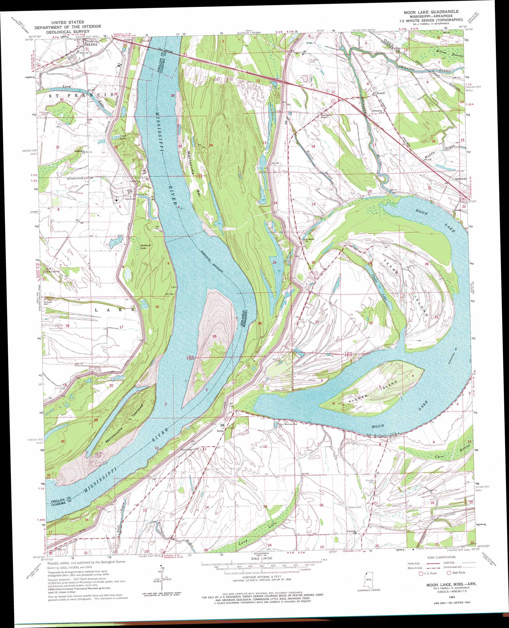
USGS Topo Quad 34090d5 - 1:24,000 scale
| Topo Map Name: | Moon Lake |
| USGS Topo Quad ID: | 34090d5 |
| Print Size: | ca. 21 1/4" wide x 27" high |
| Southeast Coordinates: | 34.375° N latitude / 90.5° W longitude |
| Map Center Coordinates: | 34.4375° N latitude / 90.5625° W longitude |
| U.S. States: | MS, AR |
| Filename: | o34090d5.jpg |
| Download Map JPG Image: | Moon Lake topo map 1:24,000 scale |
| Map Type: | Topographic |
| Topo Series: | 7.5´ |
| Map Scale: | 1:24,000 |
| Source of Map Images: | United States Geological Survey (USGS) |
| Alternate Map Versions: |
Moon Lake MS 1908, updated 1961 Download PDF Buy paper map Moon Lake MS 1964, updated 1965 Download PDF Buy paper map Moon Lake MS 1964, updated 1976 Download PDF Buy paper map Moon Lake MS 2011 Download PDF Buy paper map Moon Lake MS 2012 Download PDF Buy paper map Moon Lake MS 2015 Download PDF Buy paper map |
1:24,000 Topo Quads surrounding Moon Lake
Rondo |
Lagrange |
Stubbs Island |
Tunica |
Hollywood |
Lexa |
West Helena |
Helena |
Dundee |
Walnut Lake |
Lakeview |
Friars Point Nw |
Moon Lake |
Lula |
Falcon |
Elaine |
Friars Point |
Coahoma |
Jonestown |
Marks |
Rena Lara |
Sherard |
Clarksdale |
Sabino |
Lambert |
> Back to 34090a1 at 1:100,000 scale
> Back to 34090a1 at 1:250,000 scale
> Back to U.S. Topo Maps home
Moon Lake topo map: Gazetteer
Moon Lake: Bars
Montezuma Bar elevation 48m 157′Moon Lake: Bends
Montezuma Bend elevation 44m 144′Moon Lake: Channels
Gunhouse Chute elevation 49m 160′Montezuma Cutoff elevation 51m 167′
Montezuma Cut-Off elevation 47m 154′
Moon Lake: Guts
Phillips Bayou elevation 51m 167′Rowen Bayou elevation 54m 177′
Rush Bayou elevation 53m 173′
Moon Lake: Islands
Alcorn Island elevation 49m 160′Montezuma Towhead elevation 55m 180′
Texas Island elevation 53m 173′
Moon Lake: Lakes
Chute Lake elevation 47m 154′Long Lake elevation 52m 170′
Long Lake elevation 54m 177′
Moon Lake elevation 47m 154′
Moon Lake: Levees
Delta-Friars Point Revetment elevation 62m 203′Montezuma Towhead Dikes elevation 50m 164′
Moon Lake: Populated Places
Danforth elevation 55m 180′Delta elevation 53m 173′
Gerald (historical) elevation 53m 173′
Powell elevation 56m 183′
Stokes (historical) elevation 53m 173′
Moon Lake: Swamps
Hubbard Lake elevation 53m 173′Long Lake elevation 48m 157′
Willow Swamp elevation 51m 167′
Moon Lake digital topo map on disk
Buy this Moon Lake topo map showing relief, roads, GPS coordinates and other geographical features, as a high-resolution digital map file on DVD: