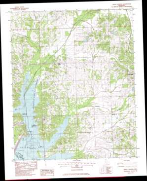
Frees Corners Topo Map Mississippi
To zoom in, hover over the map of Frees Corners
USGS Topo Quad 34090g1 - 1:24,000 scale
| Topo Map Name: | Frees Corners |
| USGS Topo Quad ID: | 34090g1 |
| Print Size: | ca. 21 1/4" wide x 27" high |
| Southeast Coordinates: | 34.75° N latitude / 90° W longitude |
| Map Center Coordinates: | 34.8125° N latitude / 90.0625° W longitude |
| U.S. State: | MS |
| Filename: | o34090g1.jpg |
| Download Map JPG Image: | Frees Corners topo map 1:24,000 scale |
| Map Type: | Topographic |
| Topo Series: | 7.5´ |
| Map Scale: | 1:24,000 |
| Source of Map Images: | United States Geological Survey (USGS) |
| Alternate Map Versions: |
Frees Corners MS 1982, updated 1982 Download PDF Buy paper map Frees Corners MS 1982, updated 1982 Download PDF Buy paper map Frees Corners MS 2012 Download PDF Buy paper map Frees Corners MS 2015 Download PDF Buy paper map |
1:24,000 Topo Quads surrounding Frees Corners
> Back to 34090e1 at 1:100,000 scale
> Back to 34090a1 at 1:250,000 scale
> Back to U.S. Topo Maps home
Frees Corners topo map: Gazetteer
Frees Corners: Dams
Arkabutla Dam elevation 66m 216′Banks Land and Cattle Company Pond Dam elevation 104m 341′
Bill Wallace Lake Dam elevation 74m 242′
Hernando Sewage Lagoon Dam elevation 91m 298′
J A Whitten Lake Dam elevation 73m 239′
J F Conger Pond Dam elevation 80m 262′
M J Simmons Pond Dam elevation 95m 311′
N B Gray Pond Dam elevation 93m 305′
R E Selph Pond Dam elevation 91m 298′
R E Selph Pond Dam elevation 80m 262′
Tom Clifton Pond Dam elevation 75m 246′
Frees Corners: Parks
Arkabutla State Waterfowl Refuge elevation 67m 219′North Abutment Public Use Area elevation 77m 252′
Plantation Point Public Use Area elevation 72m 236′
Pleasant Hill Public Use Area elevation 71m 232′
Frees Corners: Populated Places
Pleasant Hill elevation 79m 259′Robinson Gin elevation 78m 255′
Frees Corners: Reservoirs
Arkabutla Lake elevation 78m 255′Frees Corners: Streams
Cane Creek elevation 66m 216′Hurricane Creek elevation 66m 216′
Mussacuna Creek elevation 66m 216′
Panther Creek elevation 66m 216′
Wolf Creek elevation 66m 216′
Frees Corners digital topo map on disk
Buy this Frees Corners topo map showing relief, roads, GPS coordinates and other geographical features, as a high-resolution digital map file on DVD:


