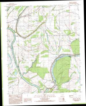
Brickeys Topo Map Arkansas
To zoom in, hover over the map of Brickeys
USGS Topo Quad 34090g5 - 1:24,000 scale
| Topo Map Name: | Brickeys |
| USGS Topo Quad ID: | 34090g5 |
| Print Size: | ca. 21 1/4" wide x 27" high |
| Southeast Coordinates: | 34.75° N latitude / 90.5° W longitude |
| Map Center Coordinates: | 34.8125° N latitude / 90.5625° W longitude |
| U.S. States: | AR, MS |
| Filename: | o34090g5.jpg |
| Download Map JPG Image: | Brickeys topo map 1:24,000 scale |
| Map Type: | Topographic |
| Topo Series: | 7.5´ |
| Map Scale: | 1:24,000 |
| Source of Map Images: | United States Geological Survey (USGS) |
| Alternate Map Versions: |
Brickeys AR 1984, updated 1985 Download PDF Buy paper map Brickeys AR 1984, updated 1993 Download PDF Buy paper map Brickeys AR 2011 Download PDF Buy paper map Brickeys AR 2014 Download PDF Buy paper map |
1:24,000 Topo Quads surrounding Brickeys
> Back to 34090e1 at 1:100,000 scale
> Back to 34090a1 at 1:250,000 scale
> Back to U.S. Topo Maps home
Brickeys topo map: Gazetteer
Brickeys: Bends
Old Walnut Bend elevation 54m 177′Brickeys: Crossings
Red Oak Ferry (historical) elevation 52m 170′Brickeys: Guts
Frenchman Bayou elevation 57m 187′Old Bordeaux Chute elevation 58m 190′
Brickeys: Islands
Bordeaux Island elevation 59m 193′Whiskey Island elevation 58m 190′
Brickeys: Lakes
Midway Lake elevation 53m 173′Mossy Lake elevation 55m 180′
Old River Lake elevation 56m 183′
Round Pond elevation 56m 183′
Brickeys: Populated Places
Askew (historical) elevation 59m 193′Beck elevation 56m 183′
Brickeys elevation 61m 200′
Gassett elevation 58m 190′
Kincade Bayou (historical) elevation 59m 193′
Park Place elevation 60m 196′
Raggio elevation 61m 200′
Spencer Place elevation 57m 187′
Tongin elevation 61m 200′
Whitehall elevation 60m 196′
Brickeys: Post Offices
Brickeys Post Office elevation 61m 200′Brickeys: Streams
Alligator Bayou elevation 52m 170′Eight Mile Reach elevation 53m 173′
Holcomb Bayou elevation 53m 173′
North Alligator Bayou elevation 53m 173′
Raft Bayou elevation 52m 170′
South Alligator Bayou elevation 53m 173′
Whiskey Chute elevation 54m 177′
Brickeys digital topo map on disk
Buy this Brickeys topo map showing relief, roads, GPS coordinates and other geographical features, as a high-resolution digital map file on DVD:


