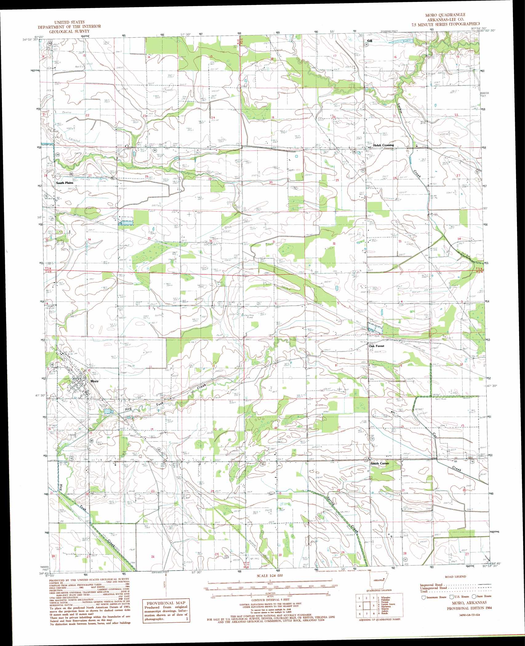
Moro Topo Map Arkansas
To zoom in, hover over the map of Moro
USGS Topo Quad 34090g8 - 1:24,000 scale
| Topo Map Name: | Moro |
| USGS Topo Quad ID: | 34090g8 |
| Print Size: | ca. 21 1/4" wide x 27" high |
| Southeast Coordinates: | 34.75° N latitude / 90.875° W longitude |
| Map Center Coordinates: | 34.8125° N latitude / 90.9375° W longitude |
| U.S. State: | AR |
| Filename: | o34090g8.jpg |
| Download Map JPG Image: | Moro topo map 1:24,000 scale |
| Map Type: | Topographic |
| Topo Series: | 7.5´ |
| Map Scale: | 1:24,000 |
| Source of Map Images: | United States Geological Survey (USGS) |
| Alternate Map Versions: |
Moro AR 1984, updated 1985 Download PDF Buy paper map Moro AR 2011 Download PDF Buy paper map Moro AR 2014 Download PDF Buy paper map |
1:24,000 Topo Quads surrounding Moro
Hunter West |
Hunter East |
Hawkins |
Forrest City |
Madison |
Brinkley |
Wheatley |
Palestine |
Haynes |
Dansby |
Keevil |
Garrett Grove |
Moro |
Marianna |
Soudan |
Park Grove |
Monroe |
Aubrey |
Rondo |
Lagrange |
Holly Grove |
Pine City |
Marvell |
Lexa |
West Helena |
> Back to 34090e1 at 1:100,000 scale
> Back to 34090a1 at 1:250,000 scale
> Back to U.S. Topo Maps home
Moro topo map: Gazetteer
Moro: Populated Places
Holub Crossing elevation 62m 203′Moro elevation 61m 200′
Oak Forest elevation 61m 200′
Smith Corner elevation 63m 206′
South Plains elevation 62m 203′
Moro digital topo map on disk
Buy this Moro topo map showing relief, roads, GPS coordinates and other geographical features, as a high-resolution digital map file on DVD: