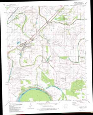
Hughes Topo Map Arkansas
To zoom in, hover over the map of Hughes
USGS Topo Quad 34090h4 - 1:24,000 scale
| Topo Map Name: | Hughes |
| USGS Topo Quad ID: | 34090h4 |
| Print Size: | ca. 21 1/4" wide x 27" high |
| Southeast Coordinates: | 34.875° N latitude / 90.375° W longitude |
| Map Center Coordinates: | 34.9375° N latitude / 90.4375° W longitude |
| U.S. States: | AR, MS |
| Filename: | o34090h4.jpg |
| Download Map JPG Image: | Hughes topo map 1:24,000 scale |
| Map Type: | Topographic |
| Topo Series: | 7.5´ |
| Map Scale: | 1:24,000 |
| Source of Map Images: | United States Geological Survey (USGS) |
| Alternate Map Versions: |
Horseshoe Lake NW AR 1975, updated 1976 Download PDF Buy paper map Hughes AR 1981, updated 1982 Download PDF Buy paper map Hughes AR 1981, updated 1993 Download PDF Buy paper map Hughes AR 2011 Download PDF Buy paper map Hughes AR 2014 Download PDF Buy paper map |
1:24,000 Topo Quads surrounding Hughes
> Back to 34090e1 at 1:100,000 scale
> Back to 34090a1 at 1:250,000 scale
> Back to U.S. Topo Maps home
Hughes topo map: Gazetteer
Hughes: Airports
Hughes Landing Strip elevation 62m 203′Tucker Field elevation 62m 203′
Hughes: Guts
Beck Bayou elevation 62m 203′Crooked Bayou elevation 60m 196′
Haltree Bayou elevation 62m 203′
Otter Slough elevation 56m 183′
Hughes: Lakes
Goose Lake elevation 62m 203′Taylor Lake elevation 62m 203′
Hughes: Populated Places
Beck elevation 64m 209′Belle Meade elevation 63m 206′
Highland Farm elevation 64m 209′
Hughes elevation 62m 203′
Midway elevation 61m 200′
Nickey (historical) elevation 62m 203′
North Hughes elevation 61m 200′
Penjur elevation 60m 196′
Red Gum Farm elevation 61m 200′
Reese elevation 63m 206′
Sycamore Bend Farm elevation 63m 206′
Hughes: Swamps
Cain Lake elevation 55m 180′Hughes digital topo map on disk
Buy this Hughes topo map showing relief, roads, GPS coordinates and other geographical features, as a high-resolution digital map file on DVD:


