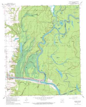
Henrico Sw Topo Map Arkansas
To zoom in, hover over the map of Henrico Sw
USGS Topo Quad 34091a2 - 1:24,000 scale
| Topo Map Name: | Henrico Sw |
| USGS Topo Quad ID: | 34091a2 |
| Print Size: | ca. 21 1/4" wide x 27" high |
| Southeast Coordinates: | 34° N latitude / 91.125° W longitude |
| Map Center Coordinates: | 34.0625° N latitude / 91.1875° W longitude |
| U.S. State: | AR |
| Filename: | o34091a2.jpg |
| Download Map JPG Image: | Henrico Sw topo map 1:24,000 scale |
| Map Type: | Topographic |
| Topo Series: | 7.5´ |
| Map Scale: | 1:24,000 |
| Source of Map Images: | United States Geological Survey (USGS) |
| Alternate Map Versions: |
Henrico SW AR 1967, updated 1968 Download PDF Buy paper map Henrico SW AR 1967, updated 1968 Download PDF Buy paper map Henrico SW AR 1967, updated 1968 Download PDF Buy paper map Henrico SW AR 2011 Download PDF Buy paper map Henrico SW AR 2014 Download PDF Buy paper map |
1:24,000 Topo Quads surrounding Henrico Sw
> Back to 34091a1 at 1:100,000 scale
> Back to 34090a1 at 1:250,000 scale
> Back to U.S. Topo Maps home
Henrico Sw topo map: Gazetteer
Henrico Sw: Bays
Jacks Bay elevation 42m 137′Johnson Bay elevation 45m 147′
Paradise Bay elevation 43m 141′
Henrico Sw: Bends
Buffalo Bend elevation 41m 134′Cow Pen Bend elevation 40m 131′
Henrico Sw: Canals
Mild Ditch elevation 42m 137′Henrico Sw: Capes
Carolina Point elevation 44m 144′Henrico Sw: Dams
Dry Lake Dam elevation 41m 134′Lock and Dam Number 1 elevation 45m 147′
Lock Number 2 elevation 49m 160′
Norrell Lock and Dam elevation 38m 124′
Whiting Reservoir Dam elevation 49m 160′
Henrico Sw: Guts
Honey Locust Bayou elevation 45m 147′Laboring Bay elevation 42m 137′
Paradise Bayou elevation 43m 141′
Prosperous Bayou elevation 41m 134′
Wolf Bayou elevation 46m 150′
Henrico Sw: Lakes
Black Lake elevation 43m 141′Brooks Lake elevation 42m 137′
Dry Lake elevation 42m 137′
East Moon Lake elevation 40m 131′
Flat Lake elevation 43m 141′
Goose Lake elevation 42m 137′
Hole in the Wall Lake elevation 43m 141′
La Grue Lake elevation 41m 134′
Little Goose Lake elevation 40m 131′
Long Lake elevation 43m 141′
Lost Lake elevation 43m 141′
Lower Parish Lake elevation 41m 134′
Mossy Lake elevation 42m 137′
Oxbow Lake elevation 43m 141′
Oxbow Lake elevation 44m 144′
Oxbow Lake elevation 44m 144′
Parish Lake elevation 41m 134′
Swan Lake elevation 40m 131′
Whisky Lake elevation 47m 154′
White Lake elevation 43m 141′
Henrico Sw: Populated Places
Jacks Bay Landing elevation 46m 150′Prairie Landing elevation 41m 134′
Henrico Sw: Reservoirs
Arkansas Post Canal Reservoir elevation 38m 124′Dry Lake elevation 41m 134′
Whiting Lake elevation 49m 160′
Henrico Sw: Streams
Bell Gully elevation 46m 150′Caney Bayou elevation 47m 154′
Honey Locust Bayou elevation 48m 157′
La Grue Bayou elevation 42m 137′
McPete Branch elevation 47m 154′
Menard Bayou elevation 41m 134′
Wildhorse Bayou elevation 42m 137′
Henrico Sw digital topo map on disk
Buy this Henrico Sw topo map showing relief, roads, GPS coordinates and other geographical features, as a high-resolution digital map file on DVD:


