Tarry Topo Map Arkansas
To zoom in, hover over the map of Tarry
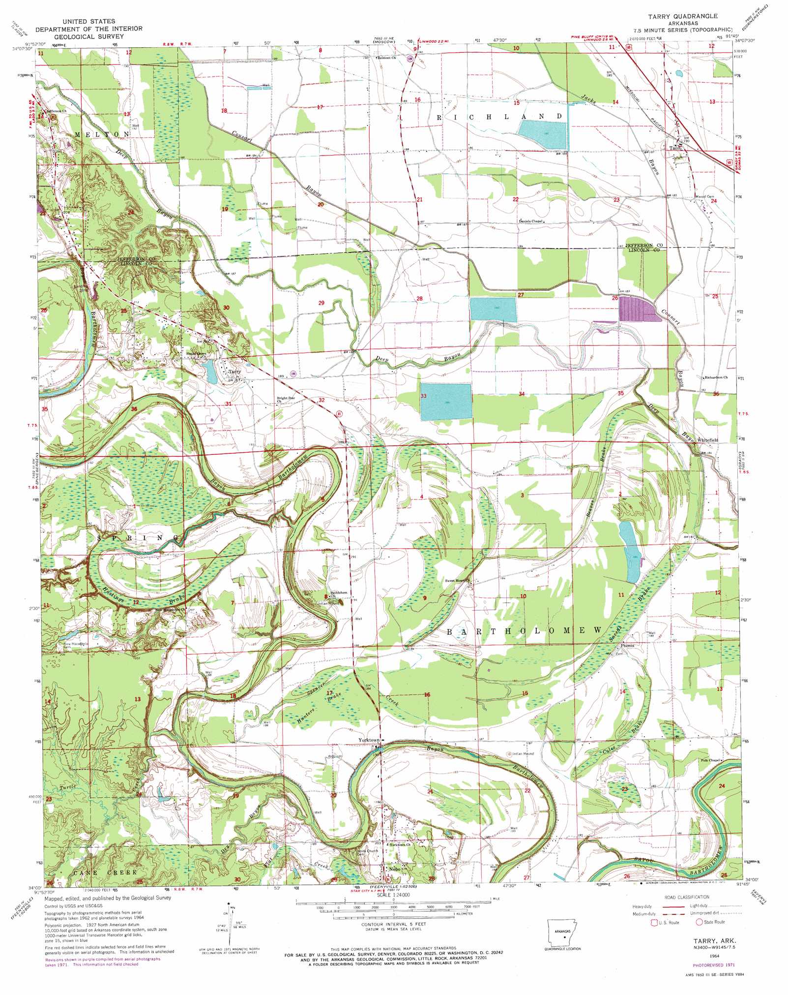
USGS Topo Quad 34091a7 - 1:24,000 scale
| Topo Map Name: | Tarry |
| USGS Topo Quad ID: | 34091a7 |
| Print Size: | ca. 21 1/4" wide x 27" high |
| Southeast Coordinates: | 34° N latitude / 91.75° W longitude |
| Map Center Coordinates: | 34.0625° N latitude / 91.8125° W longitude |
| U.S. State: | AR |
| Filename: | o34091a7.jpg |
| Download Map JPG Image: | Tarry topo map 1:24,000 scale |
| Map Type: | Topographic |
| Topo Series: | 7.5´ |
| Map Scale: | 1:24,000 |
| Source of Map Images: | United States Geological Survey (USGS) |
| Alternate Map Versions: |
Tarry AR 1964, updated 1965 Download PDF Buy paper map Tarry AR 1971, updated 1973 Download PDF Buy paper map Tarry AR 2011 Download PDF Buy paper map Tarry AR 2014 Download PDF Buy paper map |
1:24,000 Topo Quads surrounding Tarry
White Hall |
Rob Roy |
Altheimer |
Humphrey Sw |
Lodge Corner |
Pine Bluff |
Ladd |
Moscow |
Cornerstone |
Reydell |
Faith |
Pinebergen |
Tarry |
Grady |
Cades |
Calmer |
Glendale |
Star City |
Avery |
Gould |
Herbine |
Cornerville |
Relfs Bluff |
Tyro |
Gourd |
> Back to 34091a1 at 1:100,000 scale
> Back to 34090a1 at 1:250,000 scale
> Back to U.S. Topo Maps home
Tarry topo map: Gazetteer
Tarry: Bridges
Atkinson Ford Bridge elevation 55m 180′Tarry: Dams
Clowers Lake Dam elevation 61m 200′Tarry: Guts
Dry Bayou elevation 58m 190′Tarry: Populated Places
Nebo elevation 61m 200′Phenix elevation 55m 180′
Tamo elevation 57m 187′
Tarry elevation 62m 203′
Terry elevation 60m 196′
Whitefield elevation 54m 177′
Yorktown elevation 56m 183′
Tarry: Reservoirs
Clowers Lake elevation 61m 200′Tarry: Streams
Beaver Brake elevation 51m 167′Cousart Bayou elevation 51m 167′
Flat Creek elevation 57m 187′
Goosby Branch elevation 58m 190′
Jacks Bayou elevation 52m 170′
Spencer Creek elevation 55m 180′
Turtle Creek elevation 53m 173′
Tarry: Swamps
Coles Brake elevation 55m 180′Hastings Brake elevation 57m 187′
Hunters Brake elevation 56m 183′
Sneeds Brake elevation 52m 170′
Tarry digital topo map on disk
Buy this Tarry topo map showing relief, roads, GPS coordinates and other geographical features, as a high-resolution digital map file on DVD: