De Witt Topo Map Arkansas
To zoom in, hover over the map of De Witt
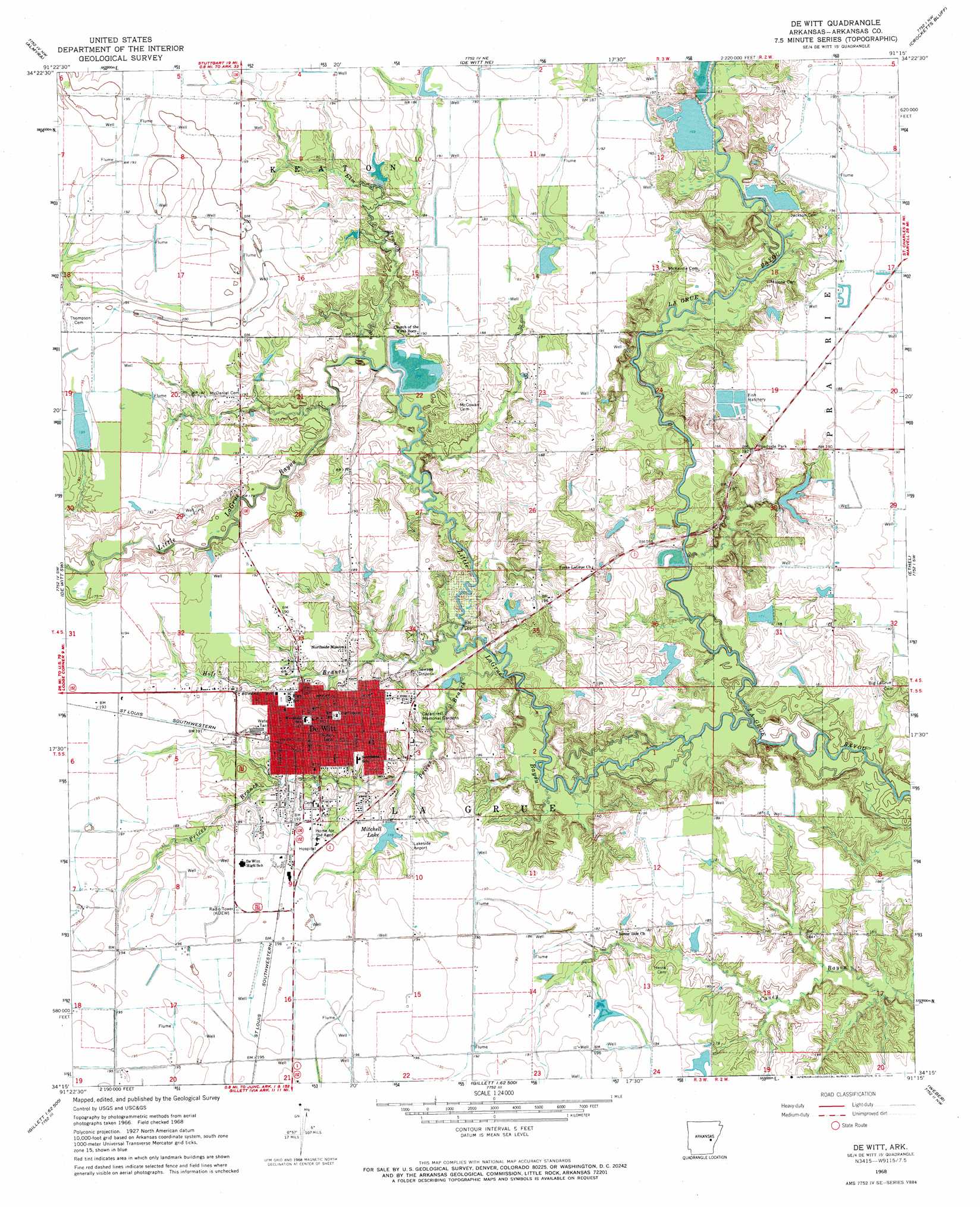
USGS Topo Quad 34091c3 - 1:24,000 scale
| Topo Map Name: | De Witt |
| USGS Topo Quad ID: | 34091c3 |
| Print Size: | ca. 21 1/4" wide x 27" high |
| Southeast Coordinates: | 34.25° N latitude / 91.25° W longitude |
| Map Center Coordinates: | 34.3125° N latitude / 91.3125° W longitude |
| U.S. State: | AR |
| Filename: | o34091c3.jpg |
| Download Map JPG Image: | De Witt topo map 1:24,000 scale |
| Map Type: | Topographic |
| Topo Series: | 7.5´ |
| Map Scale: | 1:24,000 |
| Source of Map Images: | United States Geological Survey (USGS) |
| Alternate Map Versions: |
De Witt AR 1968, updated 1969 Download PDF Buy paper map De Witt AR 2011 Download PDF Buy paper map De Witt AR 2014 Download PDF Buy paper map |
1:24,000 Topo Quads surrounding De Witt
Stuttgart North |
Ulm |
Aberdeen |
Holly Grove |
Pine City |
Stuttgart South |
Almyra |
De Witt Ne |
Crocketts Bluff |
Turner |
Lodge Corner |
De Witt Sw |
De Witt |
Ethel |
Indian Bay Se |
Reydell |
One Horse Store |
Tichnor |
Weber |
Henrico Ne |
Cades |
Gillett |
Arkansas Post |
Henrico Sw |
Snow Lake |
> Back to 34091a1 at 1:100,000 scale
> Back to 34090a1 at 1:250,000 scale
> Back to U.S. Topo Maps home
De Witt topo map: Gazetteer
De Witt: Airports
De Witt City Hospital Heliport elevation 60m 196′De Witt Municipal Airport elevation 61m 200′
Lakeside Airport elevation 58m 190′
De Witt: Canals
Ditch Number 3 elevation 60m 196′De Witt: Dams
Alter Lake Dam elevation 60m 196′Alter Lake Number Two Dam elevation 57m 187′
Arkansas Noname 288 Dam elevation 53m 173′
McKewen Lake Dam elevation 51m 167′
Miller Lake Dam elevation 49m 160′
Mitchell Lake Dam elevation 56m 183′
Union Lake Dam elevation 59m 193′
De Witt: Populated Places
De Witt elevation 58m 190′Thomwall (historical) elevation 62m 203′
De Witt: Post Offices
De Witt Post Office elevation 57m 187′De Witt: Reservoirs
Alter Lake elevation 60m 196′Alter Lake Number Two elevation 57m 187′
McKewen Lake elevation 51m 167′
Miller Lake elevation 49m 160′
Mitchell Lake elevation 56m 183′
Union Lake elevation 59m 193′
De Witt: Streams
Elm Branch elevation 52m 170′Holt Branch elevation 50m 164′
Little LaGrue Bayou elevation 47m 154′
Prices Branch elevation 50m 164′
De Witt digital topo map on disk
Buy this De Witt topo map showing relief, roads, GPS coordinates and other geographical features, as a high-resolution digital map file on DVD: