Almyra Topo Map Arkansas
To zoom in, hover over the map of Almyra
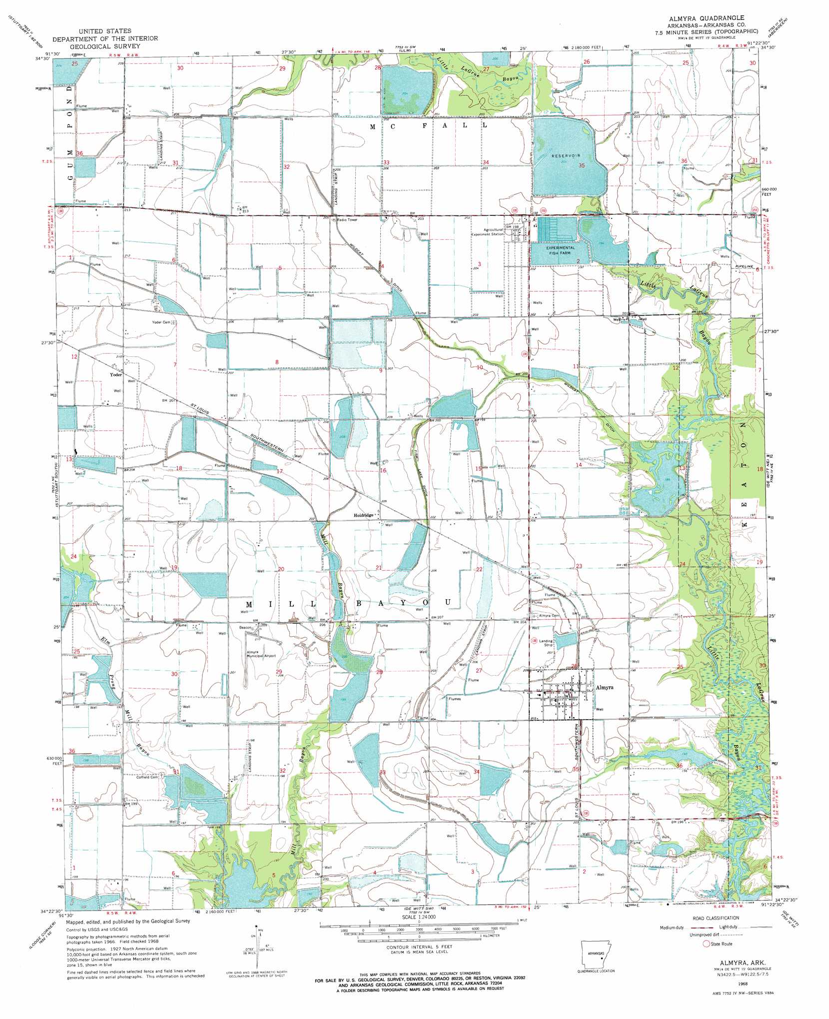
USGS Topo Quad 34091d4 - 1:24,000 scale
| Topo Map Name: | Almyra |
| USGS Topo Quad ID: | 34091d4 |
| Print Size: | ca. 21 1/4" wide x 27" high |
| Southeast Coordinates: | 34.375° N latitude / 91.375° W longitude |
| Map Center Coordinates: | 34.4375° N latitude / 91.4375° W longitude |
| U.S. State: | AR |
| Filename: | o34091d4.jpg |
| Download Map JPG Image: | Almyra topo map 1:24,000 scale |
| Map Type: | Topographic |
| Topo Series: | 7.5´ |
| Map Scale: | 1:24,000 |
| Source of Map Images: | United States Geological Survey (USGS) |
| Alternate Map Versions: |
Almyra AR 1968, updated 1969 Download PDF Buy paper map Almyra AR 2011 Download PDF Buy paper map Almyra AR 2014 Download PDF Buy paper map |
1:24,000 Topo Quads surrounding Almyra
Parkers Corner |
Slovak |
Roe |
Clarendon |
Park Grove |
Geridge |
Stuttgart North |
Ulm |
Aberdeen |
Holly Grove |
Humphrey |
Stuttgart South |
Almyra |
De Witt Ne |
Crocketts Bluff |
Humphrey Sw |
Lodge Corner |
De Witt Sw |
De Witt |
Ethel |
Cornerstone |
Reydell |
One Horse Store |
Tichnor |
Weber |
> Back to 34091a1 at 1:100,000 scale
> Back to 34090a1 at 1:250,000 scale
> Back to U.S. Topo Maps home
Almyra topo map: Gazetteer
Almyra: Airports
Almyra Municipal Airport elevation 64m 209′Almyra: Canals
Ditch Number 1 elevation 65m 213′Ditch Number 2 elevation 61m 200′
Wildcat Ditch elevation 62m 203′
Almyra: Dams
Tindall Lake Dam elevation 58m 190′Voss Reservoir Dam elevation 59m 193′
Almyra: Populated Places
Almyra elevation 64m 209′Holdridge elevation 63m 206′
Yoder elevation 66m 216′
Almyra: Reservoirs
Bennett Reservoir elevation 57m 187′Knoff Reservoir elevation 60m 196′
McDoogle Reservoir elevation 61m 200′
Tindall Lake elevation 58m 190′
Voss Reservoir elevation 59m 193′
Walworth Reservoir elevation 63m 206′
Almyra: Streams
Elm Prong Mill Bayou elevation 59m 193′Almyra digital topo map on disk
Buy this Almyra topo map showing relief, roads, GPS coordinates and other geographical features, as a high-resolution digital map file on DVD: