Wattensaw Topo Map Arkansas
To zoom in, hover over the map of Wattensaw
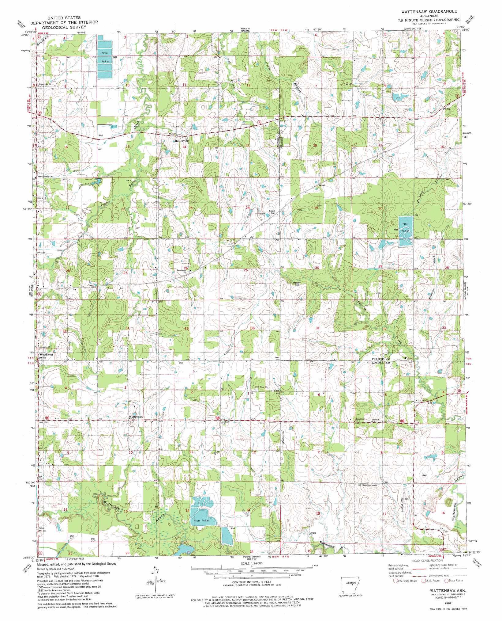
USGS Topo Quad 34091h7 - 1:24,000 scale
| Topo Map Name: | Wattensaw |
| USGS Topo Quad ID: | 34091h7 |
| Print Size: | ca. 21 1/4" wide x 27" high |
| Southeast Coordinates: | 34.875° N latitude / 91.75° W longitude |
| Map Center Coordinates: | 34.9375° N latitude / 91.8125° W longitude |
| U.S. State: | AR |
| Filename: | o34091h7.jpg |
| Download Map JPG Image: | Wattensaw topo map 1:24,000 scale |
| Map Type: | Topographic |
| Topo Series: | 7.5´ |
| Map Scale: | 1:24,000 |
| Source of Map Images: | United States Geological Survey (USGS) |
| Alternate Map Versions: |
Wattensaw AR 1982, updated 1982 Download PDF Buy paper map Wattensaw AR 2011 Download PDF Buy paper map Wattensaw AR 2014 Download PDF Buy paper map |
1:24,000 Topo Quads surrounding Wattensaw
Mount Vernon |
Floyd |
Garner |
Kensett |
West Point |
Mountain Springs |
Beebe |
Mcrae |
Walker |
Jasmine |
Cabot |
Oak Grove |
Wattensaw |
Hickory Plains |
Des Arc West |
Jacksonville |
Lonoke |
Pocket Prarie |
Carlisle |
Hazen |
Scott |
Pettus |
Culler |
Parkers Corner |
Slovak |
> Back to 34091e1 at 1:100,000 scale
> Back to 34090a1 at 1:250,000 scale
> Back to U.S. Topo Maps home
Wattensaw topo map: Gazetteer
Wattensaw: Lakes
Swan Lake elevation 71m 232′Wattensaw: Populated Places
Butlerville elevation 68m 223′Eagle Park (historical) elevation 77m 252′
Thurman elevation 74m 242′
Waterproof elevation 73m 239′
Wattensaw elevation 78m 255′
Woodlawn elevation 77m 252′
Wattensaw: Streams
Browns Branch elevation 65m 213′Wattensaw digital topo map on disk
Buy this Wattensaw topo map showing relief, roads, GPS coordinates and other geographical features, as a high-resolution digital map file on DVD: