Faith Topo Map Arkansas
To zoom in, hover over the map of Faith
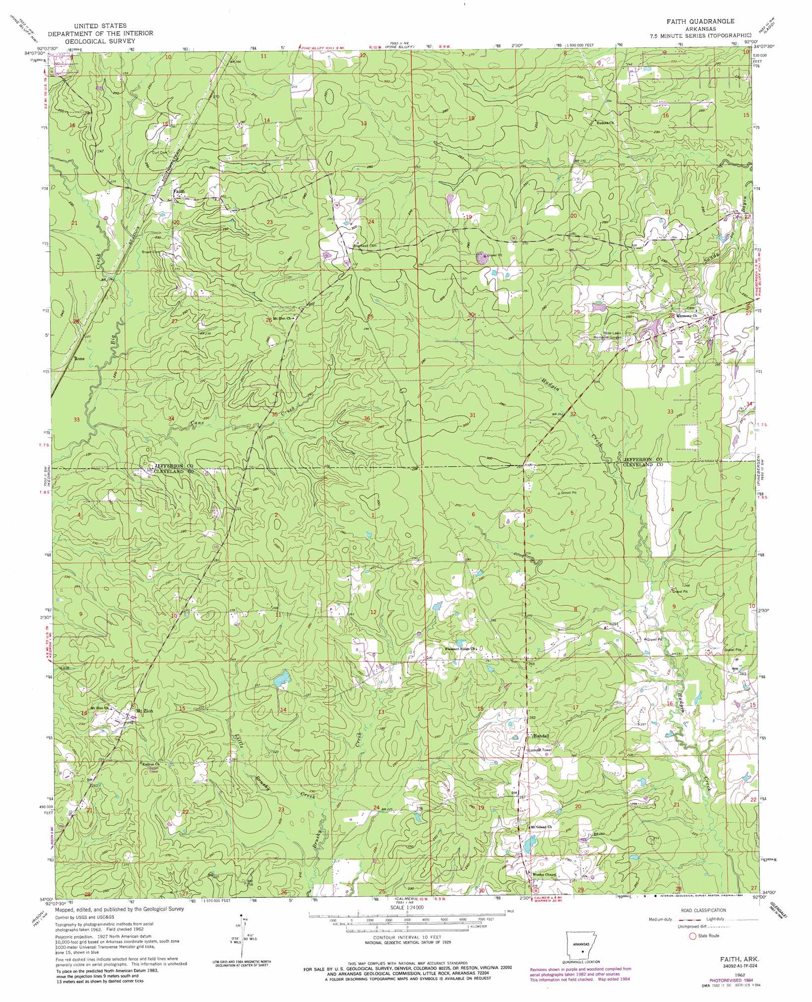
USGS Topo Quad 34092a1 - 1:24,000 scale
| Topo Map Name: | Faith |
| USGS Topo Quad ID: | 34092a1 |
| Print Size: | ca. 21 1/4" wide x 27" high |
| Southeast Coordinates: | 34° N latitude / 92° W longitude |
| Map Center Coordinates: | 34.0625° N latitude / 92.0625° W longitude |
| U.S. State: | AR |
| Filename: | o34092a1.jpg |
| Download Map JPG Image: | Faith topo map 1:24,000 scale |
| Map Type: | Topographic |
| Topo Series: | 7.5´ |
| Map Scale: | 1:24,000 |
| Source of Map Images: | United States Geological Survey (USGS) |
| Alternate Map Versions: |
Faith AR 1962, updated 1963 Download PDF Buy paper map Faith AR 1962, updated 1973 Download PDF Buy paper map Faith AR 1962, updated 1984 Download PDF Buy paper map Faith AR 2011 Download PDF Buy paper map Faith AR 2014 Download PDF Buy paper map |
1:24,000 Topo Quads surrounding Faith
Prague |
Hardin |
White Hall |
Rob Roy |
Altheimer |
Grapevine |
Pine Bluff Nw |
Pine Bluff |
Ladd |
Moscow |
Staves |
Kedron |
Faith |
Pinebergen |
Tarry |
Fordyce Ne |
Rison |
Calmer |
Glendale |
Star City |
Kingsland |
New Edinburg |
Herbine |
Cornerville |
Relfs Bluff |
> Back to 34092a1 at 1:100,000 scale
> Back to 34092a1 at 1:250,000 scale
> Back to U.S. Topo Maps home
Faith topo map: Gazetteer
Faith: Dams
Studdard Lake Dam elevation 80m 262′Faith: Populated Places
Dialton (historical) elevation 81m 265′Faith elevation 75m 246′
Lehigh (historical) elevation 79m 259′
Mount Zion elevation 80m 262′
Randall elevation 88m 288′
Faith: Reservoirs
Studdard Lake elevation 80m 262′Faith: Streams
Cane Creek elevation 65m 213′Little Brushy Creek elevation 67m 219′
Faith digital topo map on disk
Buy this Faith topo map showing relief, roads, GPS coordinates and other geographical features, as a high-resolution digital map file on DVD: