Staves Topo Map Arkansas
To zoom in, hover over the map of Staves
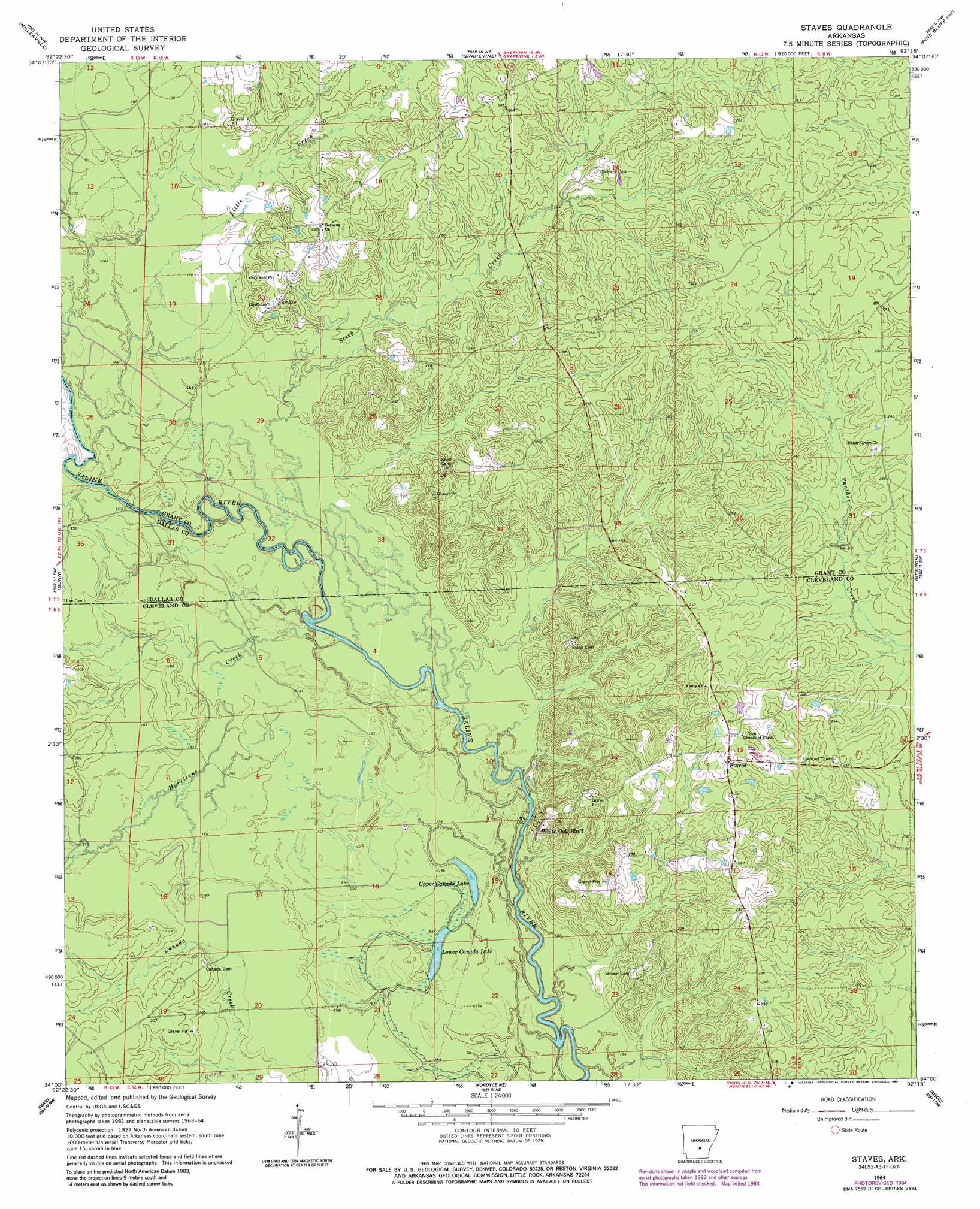
USGS Topo Quad 34092a3 - 1:24,000 scale
| Topo Map Name: | Staves |
| USGS Topo Quad ID: | 34092a3 |
| Print Size: | ca. 21 1/4" wide x 27" high |
| Southeast Coordinates: | 34° N latitude / 92.25° W longitude |
| Map Center Coordinates: | 34.0625° N latitude / 92.3125° W longitude |
| U.S. State: | AR |
| Filename: | o34092a3.jpg |
| Download Map JPG Image: | Staves topo map 1:24,000 scale |
| Map Type: | Topographic |
| Topo Series: | 7.5´ |
| Map Scale: | 1:24,000 |
| Source of Map Images: | United States Geological Survey (USGS) |
| Alternate Map Versions: |
Staves AR 1964, updated 1965 Download PDF Buy paper map Staves AR 1964, updated 1975 Download PDF Buy paper map Staves AR 1964, updated 1984 Download PDF Buy paper map Staves AR 2011 Download PDF Buy paper map Staves AR 2014 Download PDF Buy paper map |
1:24,000 Topo Quads surrounding Staves
Prattsville |
Sheridan |
Prague |
Hardin |
White Hall |
Leola |
Millerville |
Grapevine |
Pine Bluff Nw |
Pine Bluff |
Carthage |
Bunn |
Staves |
Kedron |
Faith |
Princeton East |
Ivan |
Fordyce Ne |
Rison |
Calmer |
Hopeville |
Fordyce |
Kingsland |
New Edinburg |
Herbine |
> Back to 34092a1 at 1:100,000 scale
> Back to 34092a1 at 1:250,000 scale
> Back to U.S. Topo Maps home
Staves topo map: Gazetteer
Staves: Crossings
Lees Ferry (historical) elevation 45m 147′Staves: Guts
Mink Slough elevation 51m 167′Staves: Lakes
Lower Canada Lake elevation 48m 157′Upper Canada Lake elevation 49m 160′
Staves: Populated Places
Fikes (historical) elevation 76m 249′Lamont elevation 78m 255′
Lamont (historical) elevation 79m 259′
Staves elevation 78m 255′
White Oak Bluff elevation 58m 190′
Staves: Streams
Barn Hill Creek elevation 62m 203′Canada Creek elevation 52m 170′
Hurricane Creek elevation 45m 147′
Little Creek elevation 51m 167′
Steep Creek elevation 46m 150′
Staves digital topo map on disk
Buy this Staves topo map showing relief, roads, GPS coordinates and other geographical features, as a high-resolution digital map file on DVD: