Carthage Topo Map Arkansas
To zoom in, hover over the map of Carthage
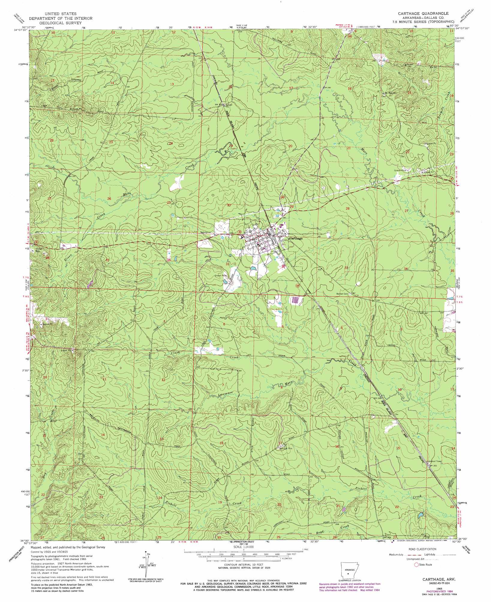
USGS Topo Quad 34092a5 - 1:24,000 scale
| Topo Map Name: | Carthage |
| USGS Topo Quad ID: | 34092a5 |
| Print Size: | ca. 21 1/4" wide x 27" high |
| Southeast Coordinates: | 34° N latitude / 92.5° W longitude |
| Map Center Coordinates: | 34.0625° N latitude / 92.5625° W longitude |
| U.S. State: | AR |
| Filename: | o34092a5.jpg |
| Download Map JPG Image: | Carthage topo map 1:24,000 scale |
| Map Type: | Topographic |
| Topo Series: | 7.5´ |
| Map Scale: | 1:24,000 |
| Source of Map Images: | United States Geological Survey (USGS) |
| Alternate Map Versions: |
Carthage AR 1965, updated 1966 Download PDF Buy paper map Carthage AR 1965, updated 1984 Download PDF Buy paper map Carthage AR 2011 Download PDF Buy paper map Carthage AR 2014 Download PDF Buy paper map |
1:24,000 Topo Quads surrounding Carthage
Malvern South |
Poyen |
Prattsville |
Sheridan |
Prague |
Round Hill |
Willow |
Leola |
Millerville |
Grapevine |
Manning |
Tulip |
Carthage |
Bunn |
Staves |
Sparkman |
Princeton West |
Princeton East |
Ivan |
Fordyce Ne |
Ouachita |
Holly Springs |
Hopeville |
Fordyce |
Kingsland |
> Back to 34092a1 at 1:100,000 scale
> Back to 34092a1 at 1:250,000 scale
> Back to U.S. Topo Maps home
Carthage topo map: Gazetteer
Carthage: Populated Places
Carthage elevation 94m 308′Carthage: Streams
Canada Creek elevation 85m 278′Clark Creek elevation 82m 269′
Dyer Moro Creek elevation 84m 275′
Green Creek elevation 104m 341′
Gum Creek elevation 77m 252′
Matthews Creek elevation 81m 265′
Williams Creek elevation 81m 265′
Carthage digital topo map on disk
Buy this Carthage topo map showing relief, roads, GPS coordinates and other geographical features, as a high-resolution digital map file on DVD: