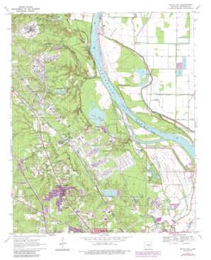
White Hall Topo Map Arkansas
To zoom in, hover over the map of White Hall
USGS Topo Quad 34092c1 - 1:24,000 scale
| Topo Map Name: | White Hall |
| USGS Topo Quad ID: | 34092c1 |
| Print Size: | ca. 21 1/4" wide x 27" high |
| Southeast Coordinates: | 34.25° N latitude / 92° W longitude |
| Map Center Coordinates: | 34.3125° N latitude / 92.0625° W longitude |
| U.S. State: | AR |
| Filename: | o34092c1.jpg |
| Download Map JPG Image: | White Hall topo map 1:24,000 scale |
| Map Type: | Topographic |
| Topo Series: | 7.5´ |
| Map Scale: | 1:24,000 |
| Source of Map Images: | United States Geological Survey (USGS) |
| Alternate Map Versions: |
White Hall AR 1970, updated 1972 Download PDF Buy paper map White Hall AR 1970, updated 1976 Download PDF Buy paper map White Hall AR 1970, updated 1978 Download PDF Buy paper map White Hall AR 1970, updated 1984 Download PDF Buy paper map White Hall AR 1970, updated 1987 Download PDF Buy paper map White Hall AR 1970, updated 1987 Download PDF Buy paper map White Hall AR 2011 Download PDF Buy paper map White Hall AR 2014 Download PDF Buy paper map |
1:24,000 Topo Quads surrounding White Hall
> Back to 34092a1 at 1:100,000 scale
> Back to 34092a1 at 1:250,000 scale
> Back to U.S. Topo Maps home
White Hall topo map: Gazetteer
White Hall: Basins
Bayou Narrow elevation 66m 216′White Hall: Bends
Hensley Bar Cutoff elevation 61m 200′Jack Bradley Bend elevation 61m 200′
Pastoria Bend elevation 62m 203′
White Hall: Canals
Main Canal elevation 62m 203′Waterloo Drainage Ditch elevation 64m 209′
White Hall: Channels
McFadden Reach (historical) elevation 65m 213′McGregor Reach (historical) elevation 61m 200′
White Hall: Cliffs
Tripletts Bluff elevation 59m 193′Yellow Bluff elevation 66m 216′
White Hall: Dams
Arsenal Lake Dam elevation 69m 226′Jones Lake Dam elevation 66m 216′
Lake Lee Dam elevation 71m 232′
Tulley Lake Dam elevation 71m 232′
White Hall: Lakes
Big Grassy Lake (historical) elevation 62m 203′Clear Pond elevation 76m 249′
Dilly Pond elevation 72m 236′
Horseshoe Pond elevation 78m 255′
White Hall: Parks
White Hall City Park elevation 89m 291′White Hall: Populated Places
Baldwin elevation 74m 242′College Park (historical) elevation 70m 229′
Dexter elevation 82m 269′
Henslee Heights elevation 87m 285′
Lamb (historical) elevation 76m 249′
Leitner elevation 78m 255′
Pastoria elevation 67m 219′
Plain View elevation 80m 262′
Warbritton elevation 70m 229′
White Hall elevation 85m 278′
White Hall: Reservoirs
Arsenal Lake elevation 69m 226′Jones Lake elevation 66m 216′
Lake Lee elevation 71m 232′
Toney Lake (historical) elevation 80m 262′
Tulley Lake elevation 71m 232′
Yell Lake (historical) elevation 65m 213′
Yellow Lake elevation 62m 203′
White Hall: Streams
Arnold Creek elevation 76m 249′Caney Bayou Fork elevation 71m 232′
Eastwood Bayou elevation 58m 190′
Gamble Creek elevation 76m 249′
Long Pond Creek elevation 66m 216′
Phillips Creek elevation 61m 200′
Smiths Bayou elevation 64m 209′
Tulley Creek elevation 64m 209′
White Hall digital topo map on disk
Buy this White Hall topo map showing relief, roads, GPS coordinates and other geographical features, as a high-resolution digital map file on DVD:


