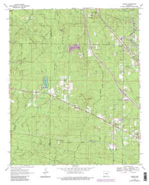
Hardin Topo Map Arkansas
To zoom in, hover over the map of Hardin
USGS Topo Quad 34092c2 - 1:24,000 scale
| Topo Map Name: | Hardin |
| USGS Topo Quad ID: | 34092c2 |
| Print Size: | ca. 21 1/4" wide x 27" high |
| Southeast Coordinates: | 34.25° N latitude / 92.125° W longitude |
| Map Center Coordinates: | 34.3125° N latitude / 92.1875° W longitude |
| U.S. State: | AR |
| Filename: | o34092c2.jpg |
| Download Map JPG Image: | Hardin topo map 1:24,000 scale |
| Map Type: | Topographic |
| Topo Series: | 7.5´ |
| Map Scale: | 1:24,000 |
| Source of Map Images: | United States Geological Survey (USGS) |
| Alternate Map Versions: |
Hardin AR 1970, updated 1972 Download PDF Buy paper map Hardin AR 1970, updated 1978 Download PDF Buy paper map Hardin AR 1970, updated 1984 Download PDF Buy paper map Hardin AR 1970, updated 1984 Download PDF Buy paper map Hardin AR 2011 Download PDF Buy paper map Hardin AR 2014 Download PDF Buy paper map |
1:24,000 Topo Quads surrounding Hardin
> Back to 34092a1 at 1:100,000 scale
> Back to 34092a1 at 1:250,000 scale
> Back to U.S. Topo Maps home
Hardin topo map: Gazetteer
Hardin: Dams
Clear Lake Dam elevation 88m 288′Hardin: Populated Places
Bruce (historical) elevation 105m 344′Clear Lake elevation 93m 305′
Donaldsonville elevation 111m 364′
Doylestown elevation 110m 360′
Eastwood elevation 100m 328′
Hardin elevation 110m 360′
Midway elevation 104m 341′
Oakland Heights elevation 98m 321′
Samples elevation 100m 328′
Hardin: Reservoirs
Clear Lake elevation 88m 288′Hardin: Streams
East Fork Derrieusseaux Creek elevation 82m 269′Little Derrieusseaux Creek elevation 85m 278′
Preacher Berry Creek elevation 80m 262′
Hardin: Summits
Gum Springs Hill elevation 128m 419′Jennings Hill elevation 129m 423′
Miller Hill elevation 122m 400′
Sanders Hill elevation 128m 419′
Hardin digital topo map on disk
Buy this Hardin topo map showing relief, roads, GPS coordinates and other geographical features, as a high-resolution digital map file on DVD:


