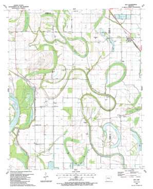
Keo Topo Map Arkansas
To zoom in, hover over the map of Keo
USGS Topo Quad 34092e1 - 1:24,000 scale
| Topo Map Name: | Keo |
| USGS Topo Quad ID: | 34092e1 |
| Print Size: | ca. 21 1/4" wide x 27" high |
| Southeast Coordinates: | 34.5° N latitude / 92° W longitude |
| Map Center Coordinates: | 34.5625° N latitude / 92.0625° W longitude |
| U.S. State: | AR |
| Filename: | o34092e1.jpg |
| Download Map JPG Image: | Keo topo map 1:24,000 scale |
| Map Type: | Topographic |
| Topo Series: | 7.5´ |
| Map Scale: | 1:24,000 |
| Source of Map Images: | United States Geological Survey (USGS) |
| Alternate Map Versions: |
Keo AR 1939, updated 1954 Download PDF Buy paper map Keo AR 1954, updated 1957 Download PDF Buy paper map Keo AR 1954, updated 1971 Download PDF Buy paper map Keo AR 1987, updated 1987 Download PDF Buy paper map Keo AR 2011 Download PDF Buy paper map Keo AR 2014 Download PDF Buy paper map |
1:24,000 Topo Quads surrounding Keo
> Back to 34092e1 at 1:100,000 scale
> Back to 34092a1 at 1:250,000 scale
> Back to U.S. Topo Maps home
Keo topo map: Gazetteer
Keo: Airports
Bredlow Airfield elevation 73m 239′Bredlow Farm Airport elevation 71m 232′
Moore Farm Airport elevation 71m 232′
Keo: Flats
Possum Flat elevation 68m 223′Keo: Forests
Grassy Woods (historical) elevation 70m 229′Keo: Guts
Gar Slough elevation 71m 232′LaBelle Bayou elevation 67m 219′
Keo: Lakes
Clear Lake elevation 67m 219′Keo: Levees
Little Rock Gillett Levee elevation 73m 239′Keo: Populated Places
Bredlow Corner elevation 71m 232′Estes elevation 73m 239′
Keo elevation 71m 232′
Wampoo elevation 72m 236′
Keo: Streams
North Bayou elevation 68m 223′Keo: Summits
Rounded Hill elevation 72m 236′Keo: Swamps
Ash Flat Lake elevation 71m 232′Cross Pond elevation 70m 229′
Cypress Pocket elevation 69m 226′
McNeely Brake elevation 70m 229′
Morris Brake elevation 66m 216′
Keo digital topo map on disk
Buy this Keo topo map showing relief, roads, GPS coordinates and other geographical features, as a high-resolution digital map file on DVD:


