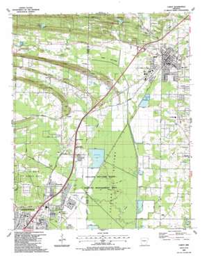
Cabot Topo Map Arkansas
To zoom in, hover over the map of Cabot
USGS Topo Quad 34092h1 - 1:24,000 scale
| Topo Map Name: | Cabot |
| USGS Topo Quad ID: | 34092h1 |
| Print Size: | ca. 21 1/4" wide x 27" high |
| Southeast Coordinates: | 34.875° N latitude / 92° W longitude |
| Map Center Coordinates: | 34.9375° N latitude / 92.0625° W longitude |
| U.S. State: | AR |
| Filename: | o34092h1.jpg |
| Download Map JPG Image: | Cabot topo map 1:24,000 scale |
| Map Type: | Topographic |
| Topo Series: | 7.5´ |
| Map Scale: | 1:24,000 |
| Source of Map Images: | United States Geological Survey (USGS) |
| Alternate Map Versions: |
Cabot AR 1954, updated 1957 Download PDF Buy paper map Cabot AR 1954, updated 1971 Download PDF Buy paper map Cabot AR 1954, updated 1976 Download PDF Buy paper map Cabot AR 1987, updated 1987 Download PDF Buy paper map Cabot AR 1994, updated 2000 Download PDF Buy paper map Cabot AR 2011 Download PDF Buy paper map Cabot AR 2014 Download PDF Buy paper map |
1:24,000 Topo Quads surrounding Cabot
> Back to 34092e1 at 1:100,000 scale
> Back to 34092a1 at 1:250,000 scale
> Back to U.S. Topo Maps home
Cabot topo map: Gazetteer
Cabot: Dams
Arkansas Noname Two Dam elevation 117m 383′Keener Lake Dam elevation 118m 387′
Taton Lake Dam elevation 87m 285′
Cabot: Flats
Ford Bottoms elevation 82m 269′Holland Bottoms elevation 76m 249′
Cabot: Guts
Ash Slough elevation 76m 249′Cabot: Lakes
Sheaffer Lake elevation 79m 259′Cabot: Parks
Crow Stadium elevation 86m 282′Holland Bottoms State Wildlife Management Area elevation 77m 252′
Stonewall Park elevation 80m 262′
Veterans Park elevation 93m 305′
Voss Park elevation 97m 318′
Cabot: Populated Places
Bailey Estates elevation 83m 272′Barger Addition elevation 97m 318′
Bel-Aire Subdivision elevation 93m 305′
Cabot elevation 90m 295′
Camilla (historical) elevation 77m 252′
Candlewood Estates elevation 87m 285′
Cannongate Addition elevation 105m 344′
Castle Heights elevation 95m 311′
Country Club Addition elevation 94m 308′
Country Lane elevation 96m 314′
Crestwood elevation 89m 291′
Deer Creek Subdivision elevation 94m 308′
Evans Estates elevation 89m 291′
Gladewood Addition elevation 120m 393′
Glenwood Estates elevation 96m 314′
Greyhawk Addition elevation 85m 278′
Head (historical) elevation 79m 259′
Holland elevation 76m 249′
Hoover Addition elevation 83m 272′
Kemp Addition elevation 152m 498′
Kingwood Addition elevation 98m 321′
Lindulake Addition elevation 131m 429′
Mark Lynn Terrace elevation 94m 308′
Meadowlark Addition elevation 84m 275′
Parnell elevation 91m 298′
Pheasant Run Addition elevation 83m 272′
Pinewoods Addition elevation 91m 298′
Rolling Hills elevation 118m 387′
Southbridge Addition elevation 84m 275′
Southside Addition elevation 87m 285′
Summit Addition elevation 129m 423′
Sunland Estates elevation 94m 308′
The Heights Addition elevation 85m 278′
The Meadows Addition elevation 88m 288′
TKO Subdivision elevation 83m 272′
Toneyville elevation 86m 282′
Waymack Addition elevation 87m 285′
Welders Wood elevation 98m 321′
Westbrook Addition elevation 92m 301′
Willow Lake Subdivision elevation 115m 377′
Cabot: Post Offices
Cabot Post Office elevation 86m 282′Cabot: Reservoirs
Cooper Lake elevation 117m 383′Keener Lake elevation 118m 387′
Pickthorne Lake elevation 78m 255′
Taton Lake elevation 87m 285′
Willow Lake elevation 101m 331′
Cabot: Ridges
Backbone Ridge elevation 131m 429′Erving Ridge elevation 126m 413′
Living Ridge elevation 123m 403′
Mill Ridge elevation 124m 406′
Cabot: Springs
Quapaw Mineral Springs elevation 78m 255′Cabot: Streams
Blue Branch elevation 87m 285′Dubb Creek elevation 77m 252′
Glade Branch elevation 77m 252′
Jacks Bayou elevation 75m 246′
Rocky Branch elevation 93m 305′
White Oak Branch elevation 79m 259′
Cabot digital topo map on disk
Buy this Cabot topo map showing relief, roads, GPS coordinates and other geographical features, as a high-resolution digital map file on DVD:


