Martindale Topo Map Arkansas
To zoom in, hover over the map of Martindale
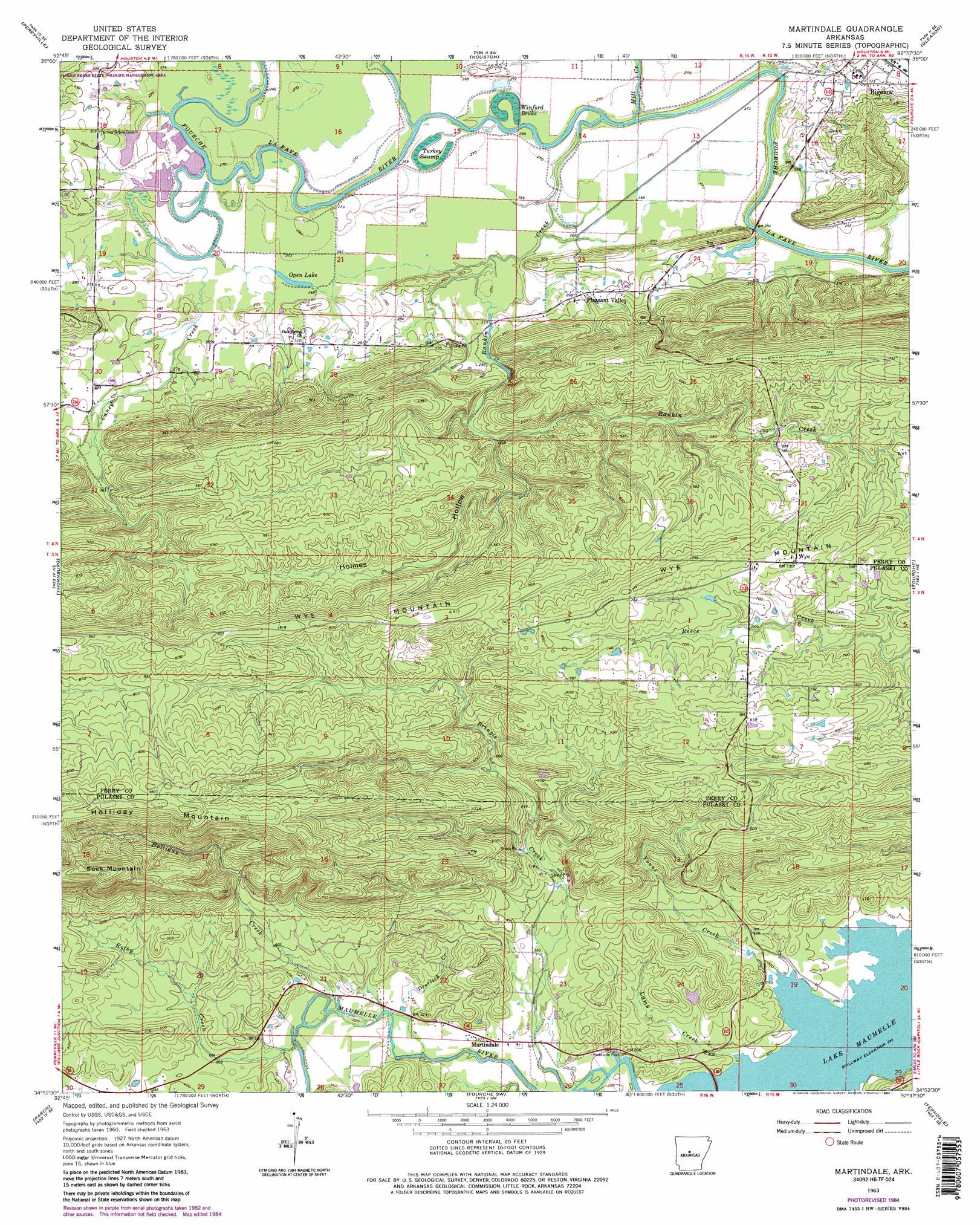
USGS Topo Quad 34092h6 - 1:24,000 scale
| Topo Map Name: | Martindale |
| USGS Topo Quad ID: | 34092h6 |
| Print Size: | ca. 21 1/4" wide x 27" high |
| Southeast Coordinates: | 34.875° N latitude / 92.625° W longitude |
| Map Center Coordinates: | 34.9375° N latitude / 92.6875° W longitude |
| U.S. State: | AR |
| Filename: | o34092h6.jpg |
| Download Map JPG Image: | Martindale topo map 1:24,000 scale |
| Map Type: | Topographic |
| Topo Series: | 7.5´ |
| Map Scale: | 1:24,000 |
| Source of Map Images: | United States Geological Survey (USGS) |
| Alternate Map Versions: |
Martindale AR 1963, updated 1964 Download PDF Buy paper map Martindale AR 1963, updated 1975 Download PDF Buy paper map Martindale AR 1963, updated 1976 Download PDF Buy paper map Martindale AR 1963, updated 1984 Download PDF Buy paper map Martindale AR 1963, updated 1984 Download PDF Buy paper map Martindale AR 2011 Download PDF Buy paper map Martindale AR 2014 Download PDF Buy paper map |
1:24,000 Topo Quads surrounding Martindale
Atkins |
Morrilton West |
Morrilton East |
Menifee |
Greenbrier |
Adona |
Perryville |
Houston |
Gleason |
Conway |
Aplin |
Thornburg |
Martindale |
Fourche |
Mayflower |
Paron Sw |
Paron |
Fourche Sw |
Ferndale |
Pinnacle Mountain |
Goosepond Moutain |
Lonsdale Ne |
Lake Norrell |
Congo |
Alexander |
> Back to 34092e1 at 1:100,000 scale
> Back to 34092a1 at 1:250,000 scale
> Back to U.S. Topo Maps home
Martindale topo map: Gazetteer
Martindale: Bars
May Shoals elevation 77m 252′Martindale: Dams
Francis Lake Dam elevation 84m 275′Van Dalsen Lake Dam elevation 91m 298′
Martindale: Lakes
Open Lake elevation 79m 259′Martindale: Parks
Sleepy Hollow Park elevation 92m 301′Martindale: Populated Places
Bellevue (historical) elevation 243m 797′Crossroads (historical) elevation 86m 282′
Graytown elevation 100m 328′
Martindale elevation 94m 308′
Oak Grove elevation 93m 305′
Orchard (historical) elevation 242m 793′
Pleasant Valley elevation 90m 295′
Rankin (historical) elevation 97m 318′
Wye elevation 224m 734′
Martindale: Reservoirs
Francis Lake elevation 84m 275′Van Dalsen Lake elevation 91m 298′
Martindale: Ridges
Holliday Mountain elevation 304m 997′Wye Mountain elevation 242m 793′
Martindale: Streams
Deerlick Creek elevation 93m 305′Holliday Creek elevation 98m 321′
Lamb Creek elevation 87m 285′
Mill Creek elevation 78m 255′
Rankin Creek elevation 77m 252′
Rothy Creek elevation 99m 324′
Yount Creek elevation 87m 285′
Martindale: Summits
Moyer Mountain elevation 212m 695′Suck Mountain elevation 321m 1053′
Martindale: Swamps
Turkey Swamp elevation 81m 265′Winford Brake elevation 81m 265′
Martindale: Valleys
Caney Creek elevation 78m 255′Holmes Hollow elevation 114m 374′
Long Hollow elevation 94m 308′
Wolf Hollow elevation 142m 465′
Martindale digital topo map on disk
Buy this Martindale topo map showing relief, roads, GPS coordinates and other geographical features, as a high-resolution digital map file on DVD: