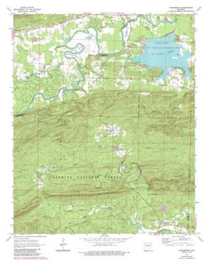
Thornburg Topo Map Arkansas
To zoom in, hover over the map of Thornburg
USGS Topo Quad 34092h7 - 1:24,000 scale
| Topo Map Name: | Thornburg |
| USGS Topo Quad ID: | 34092h7 |
| Print Size: | ca. 21 1/4" wide x 27" high |
| Southeast Coordinates: | 34.875° N latitude / 92.75° W longitude |
| Map Center Coordinates: | 34.9375° N latitude / 92.8125° W longitude |
| U.S. State: | AR |
| Filename: | o34092h7.jpg |
| Download Map JPG Image: | Thornburg topo map 1:24,000 scale |
| Map Type: | Topographic |
| Topo Series: | 7.5´ |
| Map Scale: | 1:24,000 |
| Source of Map Images: | United States Geological Survey (USGS) |
| Alternate Map Versions: |
Thornburg AR 1963, updated 1964 Download PDF Buy paper map Thornburg AR 1963, updated 1976 Download PDF Buy paper map Thornburg AR 1963, updated 1984 Download PDF Buy paper map Thornburg AR 1963, updated 1984 Download PDF Buy paper map Thornburg AR 2011 Download PDF Buy paper map Thornburg AR 2014 Download PDF Buy paper map |
| FStopo: | US Forest Service topo Thornburg is available: Download FStopo PDF Download FStopo TIF |
1:24,000 Topo Quads surrounding Thornburg
> Back to 34092e1 at 1:100,000 scale
> Back to 34092a1 at 1:250,000 scale
> Back to U.S. Topo Maps home
Thornburg topo map: Gazetteer
Thornburg: Bars
Tyler Shoals elevation 83m 272′Thornburg: Bends
Calfneck Bend elevation 85m 278′Horseshoe Bend elevation 85m 278′
Thornburg: Cliffs
Millie Bluff elevation 100m 328′Slaty Bluff elevation 79m 259′
Watson Bluff elevation 113m 370′
Thornburg: Dams
Darbys Pond Dam elevation 87m 285′Deltic Farms Lake Dam elevation 133m 436′
Harris Brake Auxillary Dam elevation 87m 285′
Harris Brake Dam elevation 84m 275′
Henry Lake Dam elevation 200m 656′
Thornburg: Falls
Sausmann Falls elevation 140m 459′Thornburg: Guts
Bull Lake Slough elevation 86m 282′Thornburg: Lakes
Bull Lake elevation 84m 275′Clear Lake elevation 83m 272′
Thornburg: Parks
Harris Brake State Wildlife Management Area elevation 84m 275′Thornburg: Populated Places
Antioch elevation 102m 334′Camp Pershing (historical) elevation 165m 541′
Cherry Hill elevation 109m 357′
Satuma elevation 232m 761′
Thornburg elevation 225m 738′
Williams Junction elevation 134m 439′
Thornburg: Reservoirs
Darbys Pond elevation 87m 285′Deltic Farms Lake elevation 133m 436′
Harris Brake elevation 85m 278′
Harris Brake Lake elevation 87m 285′
Harris Brake Public Fishing Lake elevation 84m 275′
Henry Lake elevation 200m 656′
Thornburg: Streams
Bell Branch elevation 191m 626′Brown Creek elevation 125m 410′
Cedar Creek elevation 80m 262′
Coffee Creek elevation 79m 259′
Greathouse Creek elevation 85m 278′
Houston Creek elevation 80m 262′
Little Huston Creek elevation 80m 262′
Lyons Branch elevation 184m 603′
Narrow Creek elevation 144m 472′
South Fork Brown Creek elevation 135m 442′
Tyndall Slough elevation 77m 252′
Thornburg: Summits
Sausmann Mountain elevation 327m 1072′Thornburg digital topo map on disk
Buy this Thornburg topo map showing relief, roads, GPS coordinates and other geographical features, as a high-resolution digital map file on DVD:


