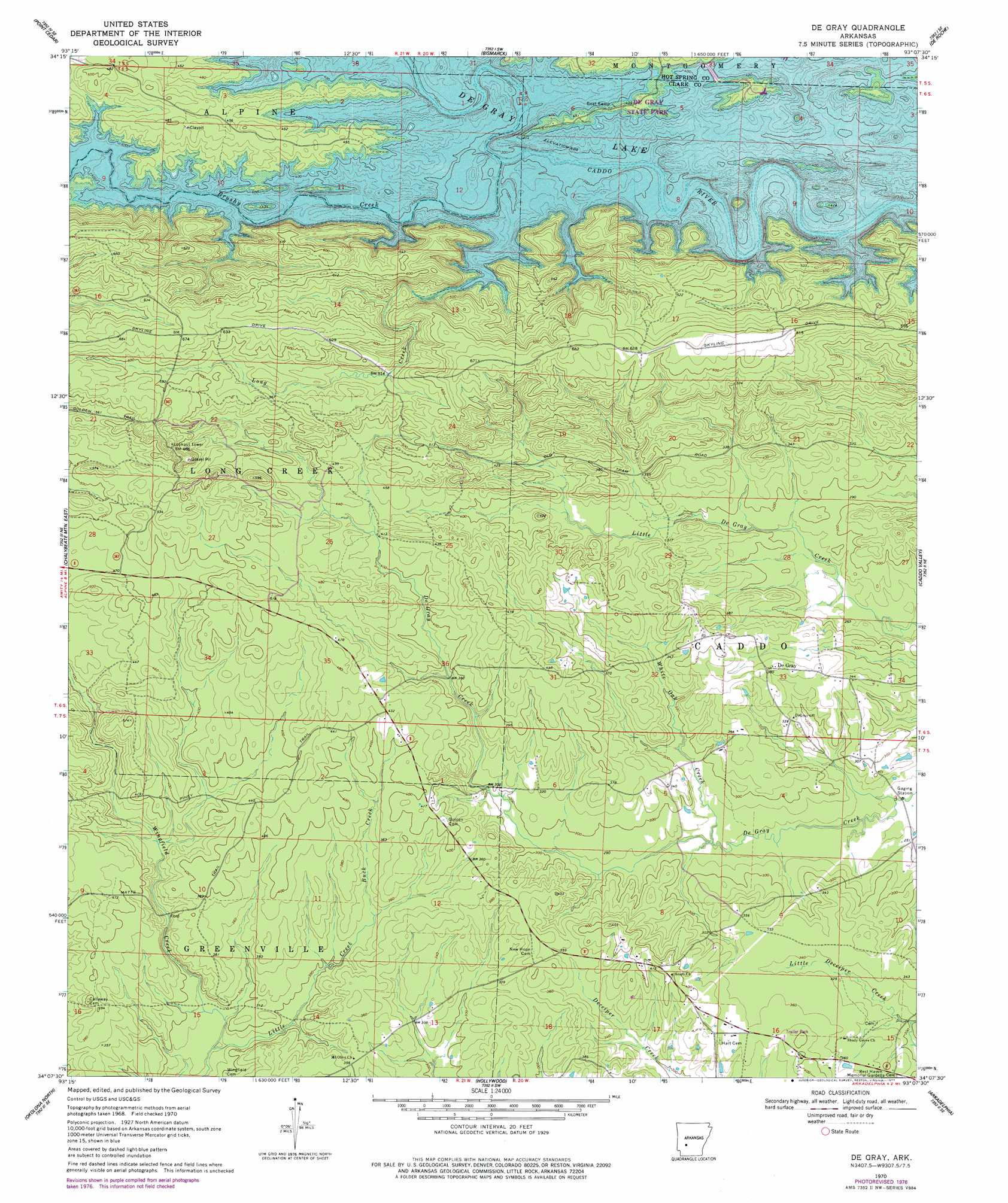
De Gray Topo Map Arkansas
To zoom in, hover over the map of De Gray
USGS Topo Quad 34093b2 - 1:24,000 scale
| Topo Map Name: | De Gray |
| USGS Topo Quad ID: | 34093b2 |
| Print Size: | ca. 21 1/4" wide x 27" high |
| Southeast Coordinates: | 34.125° N latitude / 93.125° W longitude |
| Map Center Coordinates: | 34.1875° N latitude / 93.1875° W longitude |
| U.S. State: | AR |
| Filename: | o34093b2.jpg |
| Download Map JPG Image: | De Gray topo map 1:24,000 scale |
| Map Type: | Topographic |
| Topo Series: | 7.5´ |
| Map Scale: | 1:24,000 |
| Source of Map Images: | United States Geological Survey (USGS) |
| Alternate Map Versions: |
De Gray AR 1970, updated 1976 Download PDF Buy paper map De Gray AR 1970, updated 1977 Download PDF Buy paper map De Gray AR 2011 Download PDF Buy paper map De Gray AR 2014 Download PDF Buy paper map |
1:24,000 Topo Quads surrounding De Gray
Bonnerdale |
Pearcy |
Hempwallace |
Hot Springs South |
Lake Catherine |
Amity |
Point Cedar |
Bismark |
De Roche |
Social Hill |
Chalybeate Mountain West |
Chalybeate Mountain East |
De Gray |
Caddo Valley |
Donaldson |
Antoine |
Okolona North |
Hollywood |
Arkadelphia |
Dalark |
Piney Grove |
Okolona South |
Gurdon |
Curtis |
Sparkman Nw |
> Back to 34093a1 at 1:100,000 scale
> Back to 34092a1 at 1:250,000 scale
> Back to U.S. Topo Maps home
De Gray topo map: Gazetteer
De Gray: Parks
De Gray State Park elevation 131m 429′Iron Mountain Recreation Area elevation 129m 423′
Ozan Point Recreation Area elevation 129m 423′
De Gray: Populated Places
De Gray elevation 117m 383′Hearn (historical) elevation 127m 416′
De Gray: Streams
Brushy Creek elevation 122m 400′Buck Creek elevation 103m 337′
Little Creek elevation 101m 331′
Long Creek elevation 120m 393′
White Oak Creek elevation 82m 269′
De Gray digital topo map on disk
Buy this De Gray topo map showing relief, roads, GPS coordinates and other geographical features, as a high-resolution digital map file on DVD: