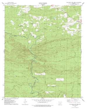
Chalybeate Mountain West Topo Map Arkansas
To zoom in, hover over the map of Chalybeate Mountain West
USGS Topo Quad 34093b4 - 1:24,000 scale
| Topo Map Name: | Chalybeate Mountain West |
| USGS Topo Quad ID: | 34093b4 |
| Print Size: | ca. 21 1/4" wide x 27" high |
| Southeast Coordinates: | 34.125° N latitude / 93.375° W longitude |
| Map Center Coordinates: | 34.1875° N latitude / 93.4375° W longitude |
| U.S. State: | AR |
| Filename: | o34093b4.jpg |
| Download Map JPG Image: | Chalybeate Mountain West topo map 1:24,000 scale |
| Map Type: | Topographic |
| Topo Series: | 7.5´ |
| Map Scale: | 1:24,000 |
| Source of Map Images: | United States Geological Survey (USGS) |
| Alternate Map Versions: |
Chalybeate Mtn West AR 1975, updated 1978 Download PDF Buy paper map Chalybeate Mountain West AR 2011 Download PDF Buy paper map Chalybeate Mountain West AR 2014 Download PDF Buy paper map |
1:24,000 Topo Quads surrounding Chalybeate Mountain West
> Back to 34093a1 at 1:100,000 scale
> Back to 34092a1 at 1:250,000 scale
> Back to U.S. Topo Maps home
Chalybeate Mountain West topo map: Gazetteer
Chalybeate Mountain West: Dams
Dwiggins Lake Dam elevation 150m 492′Chalybeate Mountain West: Populated Places
Alpine elevation 183m 600′Graysonia elevation 120m 393′
Majors elevation 122m 400′
Nutts elevation 136m 446′
Shawmut elevation 116m 380′
Chalybeate Mountain West: Reservoirs
Dwiggins Lake elevation 150m 492′Chalybeate Mountain West: Streams
Allen Branch elevation 118m 387′Camp Creek elevation 100m 328′
Caney Creek elevation 106m 347′
Little Antoine Creek elevation 114m 374′
Mathews Creek elevation 110m 360′
Rowe Creek elevation 127m 416′
Skipper Creek elevation 113m 370′
Wall Creek elevation 116m 380′
Chalybeate Mountain West: Summits
Ashworth Hill elevation 200m 656′Round Top Mountain elevation 117m 383′
Chalybeate Mountain West: Trails
Runyan Trail elevation 197m 646′Chalybeate Mountain West digital topo map on disk
Buy this Chalybeate Mountain West topo map showing relief, roads, GPS coordinates and other geographical features, as a high-resolution digital map file on DVD:


