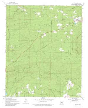
Newhope Topo Map Arkansas
To zoom in, hover over the map of Newhope
USGS Topo Quad 34093b8 - 1:24,000 scale
| Topo Map Name: | Newhope |
| USGS Topo Quad ID: | 34093b8 |
| Print Size: | ca. 21 1/4" wide x 27" high |
| Southeast Coordinates: | 34.125° N latitude / 93.875° W longitude |
| Map Center Coordinates: | 34.1875° N latitude / 93.9375° W longitude |
| U.S. State: | AR |
| Filename: | o34093b8.jpg |
| Download Map JPG Image: | Newhope topo map 1:24,000 scale |
| Map Type: | Topographic |
| Topo Series: | 7.5´ |
| Map Scale: | 1:24,000 |
| Source of Map Images: | United States Geological Survey (USGS) |
| Alternate Map Versions: |
Newhope AR 1969, updated 1972 Download PDF Buy paper map Newhope AR 1969, updated 1980 Download PDF Buy paper map Newhope AR 2011 Download PDF Buy paper map Newhope AR 2014 Download PDF Buy paper map |
1:24,000 Topo Quads surrounding Newhope
> Back to 34093a1 at 1:100,000 scale
> Back to 34092a1 at 1:250,000 scale
> Back to U.S. Topo Maps home
Newhope topo map: Gazetteer
Newhope: Populated Places
Bissell (historical) elevation 254m 833′Grandfield elevation 214m 702′
Green Plains elevation 175m 574′
Hattie (historical) elevation 172m 564′
Muddy Fork elevation 177m 580′
Newhope elevation 231m 757′
Slip-Up and Hitch (historical) elevation 230m 754′
Newhope: Post Offices
Newhope Post Office elevation 229m 751′Newhope: Streams
Bandy Creek elevation 174m 570′Long Creek elevation 212m 695′
Trout Branch elevation 151m 495′
Newhope digital topo map on disk
Buy this Newhope topo map showing relief, roads, GPS coordinates and other geographical features, as a high-resolution digital map file on DVD:


