Athens Topo Map Arkansas
To zoom in, hover over the map of Athens
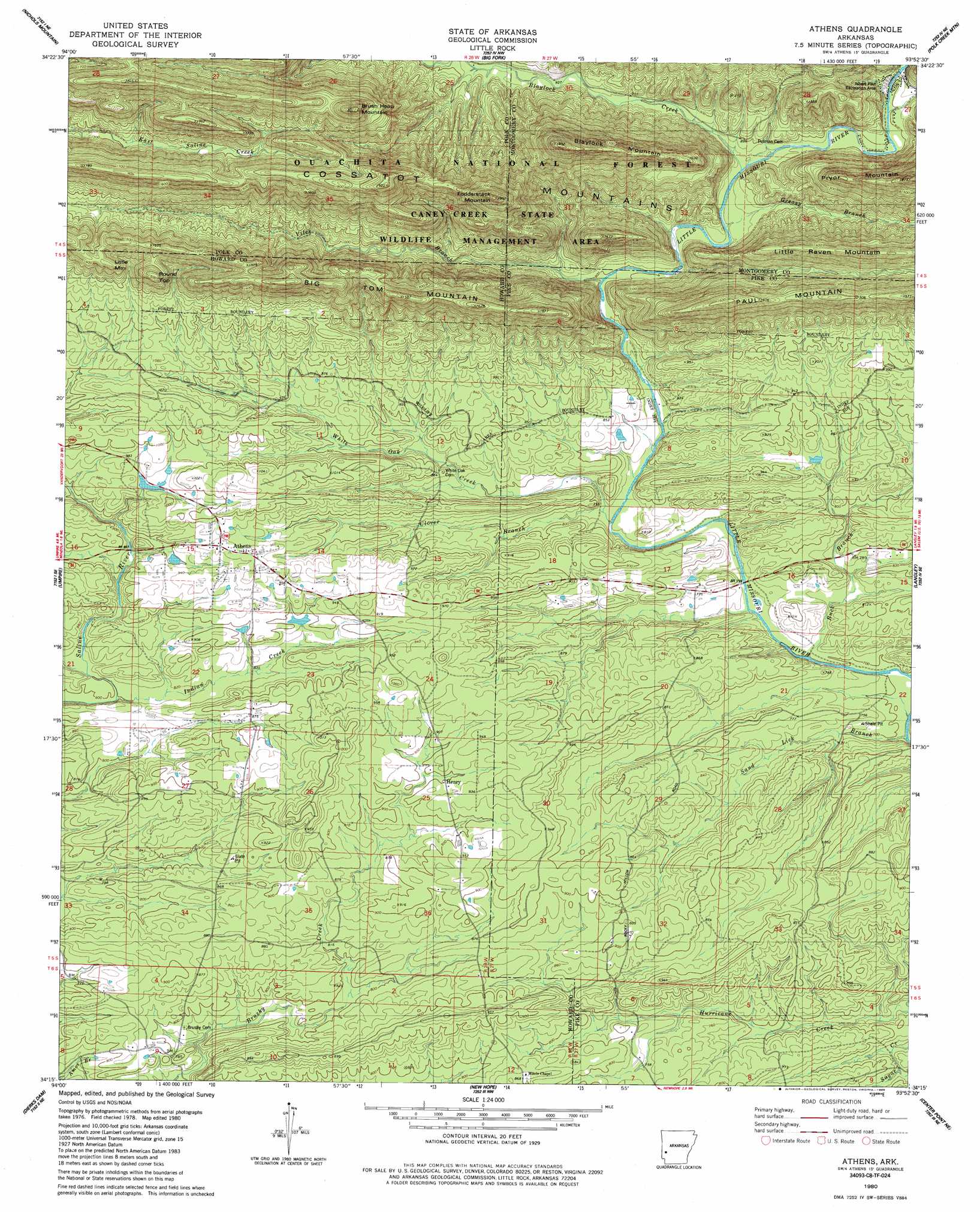
USGS Topo Quad 34093c8 - 1:24,000 scale
| Topo Map Name: | Athens |
| USGS Topo Quad ID: | 34093c8 |
| Print Size: | ca. 21 1/4" wide x 27" high |
| Southeast Coordinates: | 34.25° N latitude / 93.875° W longitude |
| Map Center Coordinates: | 34.3125° N latitude / 93.9375° W longitude |
| U.S. State: | AR |
| Filename: | o34093c8.jpg |
| Download Map JPG Image: | Athens topo map 1:24,000 scale |
| Map Type: | Topographic |
| Topo Series: | 7.5´ |
| Map Scale: | 1:24,000 |
| Source of Map Images: | United States Geological Survey (USGS) |
| Alternate Map Versions: |
Athens AR 1980, updated 1981 Download PDF Buy paper map Athens AR 1980, updated 1986 Download PDF Buy paper map Athens AR 2011 Download PDF Buy paper map Athens AR 2014 Download PDF Buy paper map |
| FStopo: | US Forest Service topo Athens is available: Download FStopo PDF Download FStopo TIF |
1:24,000 Topo Quads surrounding Athens
Mena |
Board Camp |
Pine Ridge |
Oden |
Mount Ida |
Eagle Mountain |
Nichols Nountain |
Big Fork |
Polk Creek Mountain |
Norman |
Baker Springs |
Umpire |
Athens |
Langley |
Lodi |
Gillham Dam |
Dierks Dam |
Newhope |
Center Point Ne |
Narrows Dam |
Geneva |
Dierks |
Center Point |
Nathan |
Murfreesboro |
> Back to 34093a1 at 1:100,000 scale
> Back to 34092a1 at 1:250,000 scale
> Back to U.S. Topo Maps home
Athens topo map: Gazetteer
Athens: Parks
Albert Pike Recreation Area elevation 277m 908′Athens: Populated Places
Athens elevation 293m 961′Brushy (historical) elevation 248m 813′
Henry elevation 280m 918′
Henry elevation 276m 905′
New Thompson (historical) elevation 282m 925′
Old Thompson (historical) elevation 270m 885′
Pates (historical) elevation 239m 784′
Athens: Ridges
Little Raven Mountain elevation 450m 1476′Athens: Streams
Blaylock Creek elevation 258m 846′Buck Branch elevation 221m 725′
Clover Branch elevation 231m 757′
Indian Creek elevation 260m 853′
Sand Lick Branch elevation 222m 728′
Viles Branch elevation 245m 803′
White Oak Creek elevation 227m 744′
Athens: Summits
Big Tom Mountain elevation 447m 1466′Blaylock Mountain elevation 557m 1827′
Brush Heap Mountain elevation 613m 2011′
Fodderstack Mountain elevation 556m 1824′
Little Mountain elevation 442m 1450′
Little Raven Mountain elevation 435m 1427′
Round Top elevation 454m 1489′
Athens digital topo map on disk
Buy this Athens topo map showing relief, roads, GPS coordinates and other geographical features, as a high-resolution digital map file on DVD: