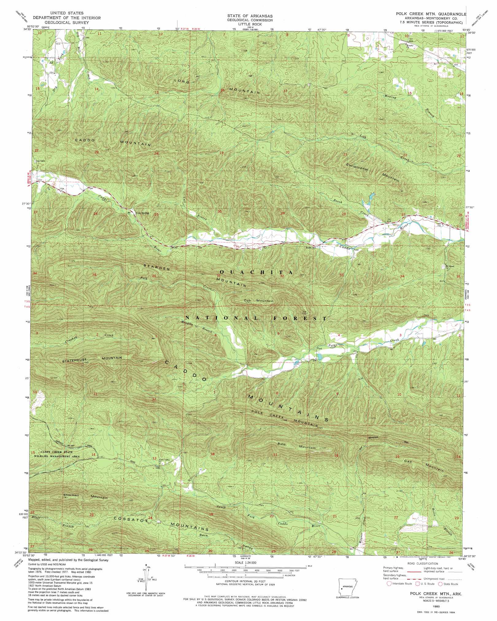
Polk Creek Mountain Topo Map Arkansas
To zoom in, hover over the map of Polk Creek Mountain
USGS Topo Quad 34093d7 - 1:24,000 scale
| Topo Map Name: | Polk Creek Mountain |
| USGS Topo Quad ID: | 34093d7 |
| Print Size: | ca. 21 1/4" wide x 27" high |
| Southeast Coordinates: | 34.375° N latitude / 93.75° W longitude |
| Map Center Coordinates: | 34.4375° N latitude / 93.8125° W longitude |
| U.S. State: | AR |
| Filename: | o34093d7.jpg |
| Download Map JPG Image: | Polk Creek Mountain topo map 1:24,000 scale |
| Map Type: | Topographic |
| Topo Series: | 7.5´ |
| Map Scale: | 1:24,000 |
| Source of Map Images: | United States Geological Survey (USGS) |
| Alternate Map Versions: |
Polk Creek Mtn AR 1980, updated 1981 Download PDF Buy paper map Polk Creek Mountain AR 2011 Download PDF Buy paper map Polk Creek Mountain AR 2014 Download PDF Buy paper map |
| FStopo: | US Forest Service topo Polk Creek Mountain is available: Download FStopo PDF Download FStopo TIF |
1:24,000 Topo Quads surrounding Polk Creek Mountain
Y City |
Buck Knob |
Bushy Creek Mountain |
Sims |
Story |
Board Camp |
Pine Ridge |
Oden |
Mount Ida |
Reed Mountain |
Nichols Nountain |
Big Fork |
Polk Creek Mountain |
Norman |
Caddo Gap |
Umpire |
Athens |
Langley |
Lodi |
Glenwood |
Dierks Dam |
Newhope |
Center Point Ne |
Narrows Dam |
Murfreesboro Ne |
> Back to 34093a1 at 1:100,000 scale
> Back to 34092a1 at 1:250,000 scale
> Back to U.S. Topo Maps home
Polk Creek Mountain topo map: Gazetteer
Polk Creek Mountain: Populated Places
Alf elevation 319m 1046′Cox Spring elevation 300m 984′
Slatington (historical) elevation 326m 1069′
Polk Creek Mountain: Ridges
Bearden Mountain elevation 412m 1351′Polk Creek Mountain: Springs
Cox Spring elevation 302m 990′Polk Creek Mountain: Streams
Call Branch elevation 278m 912′Hendrix Branch elevation 301m 987′
Wagner Creek elevation 255m 836′
Polk Creek Mountain: Summits
Bald Mountain elevation 540m 1771′Christopher Mountain elevation 387m 1269′
Cub Mountain elevation 504m 1653′
Long Mountain elevation 366m 1200′
Polk Creek Mountain elevation 462m 1515′
Sherman Mountain elevation 532m 1745′
Polk Creek Mountain: Trails
Gap Mountain Trail elevation 436m 1430′Polk Creek Mountain digital topo map on disk
Buy this Polk Creek Mountain topo map showing relief, roads, GPS coordinates and other geographical features, as a high-resolution digital map file on DVD: