Pine Ridge Topo Map Arkansas
To zoom in, hover over the map of Pine Ridge
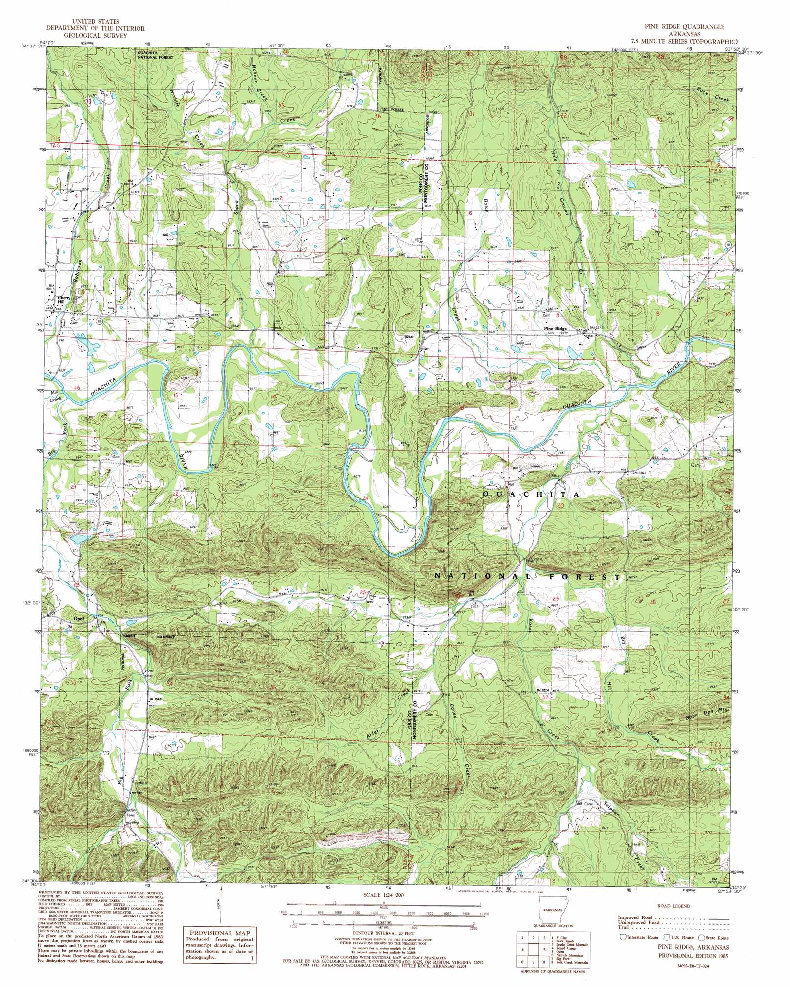
USGS Topo Quad 34093e8 - 1:24,000 scale
| Topo Map Name: | Pine Ridge |
| USGS Topo Quad ID: | 34093e8 |
| Print Size: | ca. 21 1/4" wide x 27" high |
| Southeast Coordinates: | 34.5° N latitude / 93.875° W longitude |
| Map Center Coordinates: | 34.5625° N latitude / 93.9375° W longitude |
| U.S. State: | AR |
| Filename: | o34093e8.jpg |
| Download Map JPG Image: | Pine Ridge topo map 1:24,000 scale |
| Map Type: | Topographic |
| Topo Series: | 7.5´ |
| Map Scale: | 1:24,000 |
| Source of Map Images: | United States Geological Survey (USGS) |
| Alternate Map Versions: |
Pine Ridge AR 1985, updated 1986 Download PDF Buy paper map Pine Ridge AR 2011 Download PDF Buy paper map Pine Ridge AR 2014 Download PDF Buy paper map |
| FStopo: | US Forest Service topo Pine Ridge is available: Download FStopo PDF Download FStopo TIF |
1:24,000 Topo Quads surrounding Pine Ridge
Peanut Mountain |
Boles |
Parks |
Harvey |
Little Texas |
Acorn |
Y City |
Buck Knob |
Bushy Creek Mountain |
Sims |
Mena |
Board Camp |
Pine Ridge |
Oden |
Mount Ida |
Eagle Mountain |
Nichols Nountain |
Big Fork |
Polk Creek Mountain |
Norman |
Baker Springs |
Umpire |
Athens |
Langley |
Lodi |
> Back to 34093e1 at 1:100,000 scale
> Back to 34092a1 at 1:250,000 scale
> Back to U.S. Topo Maps home
Pine Ridge topo map: Gazetteer
Pine Ridge: Dams
Faulkner Lake Dam elevation 274m 898′Hatfield Lake Dam elevation 259m 849′
Pine Ridge: Populated Places
Cherry Hill elevation 271m 889′Opal elevation 271m 889′
Pine Ridge elevation 257m 843′
Pine Ridge: Post Offices
Pine Ridge Post Office elevation 254m 833′Pine Ridge: Reservoirs
Faulkner Lake elevation 274m 898′Hatfield Lake elevation 259m 849′
Pine Ridge: Streams
Alder Creek elevation 261m 856′Big Fork elevation 250m 820′
Big Hill Creek elevation 244m 800′
Bolan Creek elevation 233m 764′
Caney Creek elevation 245m 803′
Hole in the Ground Creek elevation 234m 767′
Hoover Creek elevation 288m 944′
Kates Creek elevation 236m 774′
Mill Creek elevation 253m 830′
Nesbitt Creek elevation 277m 908′
Shack Creek elevation 245m 803′
Sulphur Creek elevation 262m 859′
Pine Ridge digital topo map on disk
Buy this Pine Ridge topo map showing relief, roads, GPS coordinates and other geographical features, as a high-resolution digital map file on DVD: