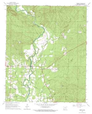
Geneva Topo Map Arkansas
To zoom in, hover over the map of Geneva
USGS Topo Quad 34094a2 - 1:24,000 scale
| Topo Map Name: | Geneva |
| USGS Topo Quad ID: | 34094a2 |
| Print Size: | ca. 21 1/4" wide x 27" high |
| Southeast Coordinates: | 34° N latitude / 94.125° W longitude |
| Map Center Coordinates: | 34.0625° N latitude / 94.1875° W longitude |
| U.S. State: | AR |
| Filename: | o34094a2.jpg |
| Download Map JPG Image: | Geneva topo map 1:24,000 scale |
| Map Type: | Topographic |
| Topo Series: | 7.5´ |
| Map Scale: | 1:24,000 |
| Source of Map Images: | United States Geological Survey (USGS) |
| Alternate Map Versions: |
Geneva AR 1966, updated 1967 Download PDF Buy paper map Geneva AR 2011 Download PDF Buy paper map Geneva AR 2014 Download PDF Buy paper map |
1:24,000 Topo Quads surrounding Geneva
> Back to 34094a1 at 1:100,000 scale
> Back to 34094a1 at 1:250,000 scale
> Back to U.S. Topo Maps home
Geneva topo map: Gazetteer
Geneva: Crossings
Battle Ford elevation 103m 337′McKinney Ford elevation 107m 351′
Moody Shoal Ford elevation 108m 354′
Rolling Shoal Ford elevation 111m 364′
Steel Ford elevation 110m 360′
Geneva: Guts
Mound Slough elevation 105m 344′Geneva: Lakes
Johnson Lake elevation 103m 337′Geneva: Populated Places
Geneva elevation 111m 364′Red Hill (historical) elevation 140m 459′
Red Wing elevation 121m 396′
Geneva: Streams
Buck Creek elevation 102m 334′Burke Creek elevation 107m 351′
Hale Creek elevation 110m 360′
Johnson Creek elevation 105m 344′
Geneva digital topo map on disk
Buy this Geneva topo map showing relief, roads, GPS coordinates and other geographical features, as a high-resolution digital map file on DVD:


