Steel Junction Topo Map Oklahoma
To zoom in, hover over the map of Steel Junction
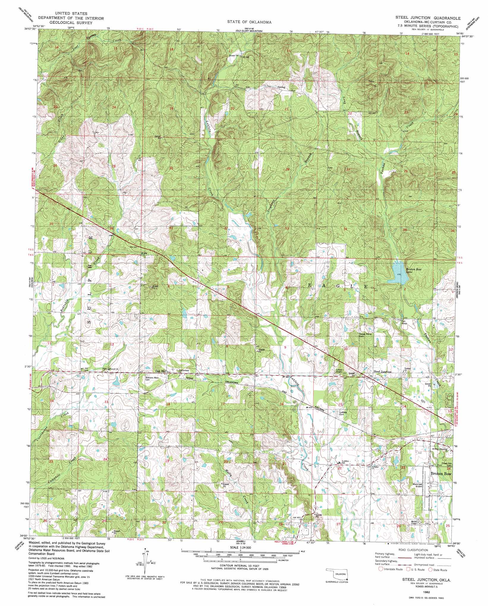
USGS Topo Quad 34094a7 - 1:24,000 scale
| Topo Map Name: | Steel Junction |
| USGS Topo Quad ID: | 34094a7 |
| Print Size: | ca. 21 1/4" wide x 27" high |
| Southeast Coordinates: | 34° N latitude / 94.75° W longitude |
| Map Center Coordinates: | 34.0625° N latitude / 94.8125° W longitude |
| U.S. State: | OK |
| Filename: | o34094a7.jpg |
| Download Map JPG Image: | Steel Junction topo map 1:24,000 scale |
| Map Type: | Topographic |
| Topo Series: | 7.5´ |
| Map Scale: | 1:24,000 |
| Source of Map Images: | United States Geological Survey (USGS) |
| Alternate Map Versions: |
Steel Junction OK 1982, updated 1983 Download PDF Buy paper map Steel Junction OK 2010 Download PDF Buy paper map Steel Junction OK 2012 Download PDF Buy paper map Steel Junction OK 2016 Download PDF Buy paper map |
| FStopo: | US Forest Service topo Steel Junction is available: Download FStopo PDF Download FStopo TIF |
1:24,000 Topo Quads surrounding Steel Junction
Signal Mountain |
Rockey Creek |
Bethel |
Hee Creek |
Big Hudson Creek |
Alikchi |
Bear Mountain |
Old Glory Mountain |
Stephens Gap |
Toblerville |
Wright City |
Golden |
Steel Junction |
Broken Bow |
Eagletown |
Millerton |
Garvin |
Idabel |
Shults |
Goodwater |
Negley |
Acworth |
Idabel Se |
Haworth |
Bokhoma |
> Back to 34094a1 at 1:100,000 scale
> Back to 34094a1 at 1:250,000 scale
> Back to U.S. Topo Maps home
Steel Junction topo map: Gazetteer
Steel Junction: Airports
Broken Bow Airport elevation 123m 403′Steel Junction: Dams
Broken Bow City Dam elevation 192m 629′Broken Bow City Lake Dam elevation 156m 511′
Steel Junction: Lakes
Broken Bow Lake elevation 144m 472′Steel Junction: Populated Places
Oak Hill elevation 153m 501′Steel Junction elevation 153m 501′
Steel Junction: Reservoirs
Broken Bow City Lake elevation 156m 511′Broken Bow City Lake elevation 192m 629′
Steel Junction: Streams
Long Branch elevation 158m 518′Stephens Branch elevation 131m 429′
Steel Junction digital topo map on disk
Buy this Steel Junction topo map showing relief, roads, GPS coordinates and other geographical features, as a high-resolution digital map file on DVD: