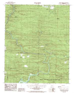
Baker Springs Topo Map Arkansas
To zoom in, hover over the map of Baker Springs
USGS Topo Quad 34094c2 - 1:24,000 scale
| Topo Map Name: | Baker Springs |
| USGS Topo Quad ID: | 34094c2 |
| Print Size: | ca. 21 1/4" wide x 27" high |
| Southeast Coordinates: | 34.25° N latitude / 94.125° W longitude |
| Map Center Coordinates: | 34.3125° N latitude / 94.1875° W longitude |
| U.S. State: | AR |
| Filename: | o34094c2.jpg |
| Download Map JPG Image: | Baker Springs topo map 1:24,000 scale |
| Map Type: | Topographic |
| Topo Series: | 7.5´ |
| Map Scale: | 1:24,000 |
| Source of Map Images: | United States Geological Survey (USGS) |
| Alternate Map Versions: |
Baker Springs AR 1986, updated 1986 Download PDF Buy paper map Baker Springs AR 2011 Download PDF Buy paper map Baker Springs AR 2014 Download PDF Buy paper map |
| FStopo: | US Forest Service topo Baker Springs is available: Download FStopo PDF Download FStopo TIF |
1:24,000 Topo Quads surrounding Baker Springs
> Back to 34094a1 at 1:100,000 scale
> Back to 34094a1 at 1:250,000 scale
> Back to U.S. Topo Maps home
Baker Springs topo map: Gazetteer
Baker Springs: Crossings
Baker Ford elevation 171m 561′Church Ford elevation 157m 515′
Cow Creek Ford elevation 179m 587′
Planner Ford elevation 222m 728′
Pryor Ford elevation 200m 656′
Rankin Ford elevation 152m 498′
Baker Springs: Populated Places
Baker Springs elevation 203m 666′Duckett elevation 269m 882′
Duckett Ford elevation 151m 495′
Hartley elevation 322m 1056′
Pryor Ridge (historical) elevation 297m 974′
Baker Springs: Streams
Baker Creek elevation 170m 557′Cow Creek elevation 184m 603′
Faulkner Branch elevation 281m 921′
Harris Creek elevation 161m 528′
Opossum Creek elevation 153m 501′
Pryor Creek elevation 201m 659′
White Oak Creek elevation 159m 521′
Baker Springs: Valleys
Devils Hollow elevation 190m 623′Baker Springs digital topo map on disk
Buy this Baker Springs topo map showing relief, roads, GPS coordinates and other geographical features, as a high-resolution digital map file on DVD:


