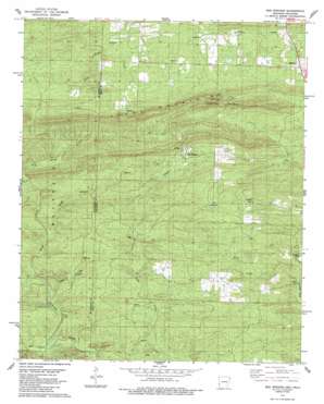
Bog Springs Topo Map Arkansas
To zoom in, hover over the map of Bog Springs
USGS Topo Quad 34094c4 - 1:24,000 scale
| Topo Map Name: | Bog Springs |
| USGS Topo Quad ID: | 34094c4 |
| Print Size: | ca. 21 1/4" wide x 27" high |
| Southeast Coordinates: | 34.25° N latitude / 94.375° W longitude |
| Map Center Coordinates: | 34.3125° N latitude / 94.4375° W longitude |
| U.S. States: | AR, OK |
| Filename: | o34094c4.jpg |
| Download Map JPG Image: | Bog Springs topo map 1:24,000 scale |
| Map Type: | Topographic |
| Topo Series: | 7.5´ |
| Map Scale: | 1:24,000 |
| Source of Map Images: | United States Geological Survey (USGS) |
| Alternate Map Versions: |
Bog Springs AR 1985, updated 1985 Download PDF Buy paper map Bog Springs AR 2011 Download PDF Buy paper map Bog Springs AR 2014 Download PDF Buy paper map |
1:24,000 Topo Quads surrounding Bog Springs
> Back to 34094a1 at 1:100,000 scale
> Back to 34094a1 at 1:250,000 scale
> Back to U.S. Topo Maps home
Bog Springs topo map: Gazetteer
Bog Springs: Crossings
Odell Ford elevation 253m 830′Bog Springs: Populated Places
Bog Springs elevation 367m 1204′Roff (historical) elevation 375m 1230′
Bog Springs: Post Offices
Hatton Post Office elevation 361m 1184′Bog Springs: Ridges
Cross Mountains elevation 394m 1292′Bog Springs: Springs
Bog Springs elevation 352m 1154′Twin Springs elevation 382m 1253′
Bog Springs: Streams
Bull Creek elevation 244m 800′Cedar Branch elevation 261m 856′
Cedar Branch elevation 262m 859′
Kings Branch elevation 285m 935′
Kings Branch elevation 283m 928′
Rough Creek elevation 268m 879′
Rough Creek elevation 267m 875′
West Creek elevation 254m 833′
Bog Springs: Summits
Whiskey Peak elevation 508m 1666′Bog Springs digital topo map on disk
Buy this Bog Springs topo map showing relief, roads, GPS coordinates and other geographical features, as a high-resolution digital map file on DVD:


