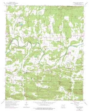
Board Camp Topo Map Arkansas
To zoom in, hover over the map of Board Camp
USGS Topo Quad 34094e1 - 1:24,000 scale
| Topo Map Name: | Board Camp |
| USGS Topo Quad ID: | 34094e1 |
| Print Size: | ca. 21 1/4" wide x 27" high |
| Southeast Coordinates: | 34.5° N latitude / 94° W longitude |
| Map Center Coordinates: | 34.5625° N latitude / 94.0625° W longitude |
| U.S. State: | AR |
| Filename: | o34094e1.jpg |
| Download Map JPG Image: | Board Camp topo map 1:24,000 scale |
| Map Type: | Topographic |
| Topo Series: | 7.5´ |
| Map Scale: | 1:24,000 |
| Source of Map Images: | United States Geological Survey (USGS) |
| Alternate Map Versions: |
Board Camp AR 1958, updated 1959 Download PDF Buy paper map Board Camp AR 1958, updated 1976 Download PDF Buy paper map Board Camp AR 2011 Download PDF Buy paper map Board Camp AR 2014 Download PDF Buy paper map |
| FStopo: | US Forest Service topo Board Camp is available: Download FStopo PDF Download FStopo TIF |
1:24,000 Topo Quads surrounding Board Camp
> Back to 34094e1 at 1:100,000 scale
> Back to 34094a1 at 1:250,000 scale
> Back to U.S. Topo Maps home
Board Camp topo map: Gazetteer
Board Camp: Dams
Dairy Lake Dam elevation 281m 921′Forbis Lake Dam elevation 293m 961′
J and B Lake Dam elevation 261m 856′
Board Camp: Populated Places
Board Camp elevation 292m 958′Ink elevation 317m 1040′
Pine Grove elevation 306m 1003′
Yocana elevation 285m 935′
Board Camp: Reservoirs
Dairy Lake elevation 281m 921′Forbis Lake elevation 293m 961′
J and B Lake elevation 261m 856′
Board Camp: Streams
Board Camp Creek elevation 265m 869′Boggy Creek elevation 259m 849′
Cedar Creek elevation 272m 892′
Gap Creek elevation 271m 889′
Loftis Creek elevation 264m 866′
Macks Creek elevation 279m 915′
Polk Creek elevation 260m 853′
Robinson Creek elevation 253m 830′
Southern Creek elevation 258m 846′
Sulphur Creek elevation 261m 856′
Turbin Creek elevation 254m 833′
Board Camp: Summits
Goldsberry Mountain elevation 474m 1555′Board Camp digital topo map on disk
Buy this Board Camp topo map showing relief, roads, GPS coordinates and other geographical features, as a high-resolution digital map file on DVD:


