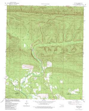
Octavia Topo Map Oklahoma
To zoom in, hover over the map of Octavia
USGS Topo Quad 34094e6 - 1:24,000 scale
| Topo Map Name: | Octavia |
| USGS Topo Quad ID: | 34094e6 |
| Print Size: | ca. 21 1/4" wide x 27" high |
| Southeast Coordinates: | 34.5° N latitude / 94.625° W longitude |
| Map Center Coordinates: | 34.5625° N latitude / 94.6875° W longitude |
| U.S. State: | OK |
| Filename: | o34094e6.jpg |
| Download Map JPG Image: | Octavia topo map 1:24,000 scale |
| Map Type: | Topographic |
| Topo Series: | 7.5´ |
| Map Scale: | 1:24,000 |
| Source of Map Images: | United States Geological Survey (USGS) |
| Alternate Map Versions: |
Octavia OK 1981, updated 1981 Download PDF Buy paper map Octavia OK 2011 Download PDF Buy paper map Octavia OK 2012 Download PDF Buy paper map Octavia OK 2016 Download PDF Buy paper map |
| FStopo: | US Forest Service topo Octavia is available: Download FStopo PDF Download FStopo TIF |
1:24,000 Topo Quads surrounding Octavia
> Back to 34094e1 at 1:100,000 scale
> Back to 34094a1 at 1:250,000 scale
> Back to U.S. Topo Maps home
Octavia topo map: Gazetteer
Octavia: Parks
Three Sticks Monument elevation 618m 2027′Octavia: Populated Places
Octavia elevation 276m 905′Octavia: Streams
Cucumber Creek elevation 316m 1036′Cucumber Creek elevation 304m 997′
Little Eagle Creek elevation 244m 800′
Saddle Rock Creek elevation 315m 1033′
Octavia digital topo map on disk
Buy this Octavia topo map showing relief, roads, GPS coordinates and other geographical features, as a high-resolution digital map file on DVD:


