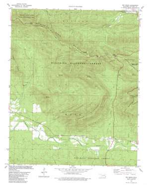
Big Cedar Topo Map Oklahoma
To zoom in, hover over the map of Big Cedar
USGS Topo Quad 34094f6 - 1:24,000 scale
| Topo Map Name: | Big Cedar |
| USGS Topo Quad ID: | 34094f6 |
| Print Size: | ca. 21 1/4" wide x 27" high |
| Southeast Coordinates: | 34.625° N latitude / 94.625° W longitude |
| Map Center Coordinates: | 34.6875° N latitude / 94.6875° W longitude |
| U.S. State: | OK |
| Filename: | o34094f6.jpg |
| Download Map JPG Image: | Big Cedar topo map 1:24,000 scale |
| Map Type: | Topographic |
| Topo Series: | 7.5´ |
| Map Scale: | 1:24,000 |
| Source of Map Images: | United States Geological Survey (USGS) |
| Alternate Map Versions: |
Big Cedar OK 1981, updated 1981 Download PDF Buy paper map Big Cedar OK 2011 Download PDF Buy paper map Big Cedar OK 2013 Download PDF Buy paper map Big Cedar OK 2016 Download PDF Buy paper map |
| FStopo: | US Forest Service topo Big Cedar is available: Download FStopo PDF Download FStopo TIF |
1:24,000 Topo Quads surrounding Big Cedar
> Back to 34094e1 at 1:100,000 scale
> Back to 34094a1 at 1:250,000 scale
> Back to U.S. Topo Maps home
Big Cedar topo map: Gazetteer
Big Cedar: Dams
Sallisaw Creek Site 17 Dam elevation 420m 1377′Big Cedar: Parks
Robert S Kerr Arboretum elevation 441m 1446′Big Cedar: Populated Places
Big Cedar elevation 266m 872′Big Cedar: Reservoirs
Sallisaw Creek Site 17 Reservoir elevation 420m 1377′Big Cedar: Ridges
Tram Ridge elevation 328m 1076′Winding Stair Mountain elevation 744m 2440′
Big Cedar: Springs
Horse Thief Springs elevation 531m 1742′Pipe Spring elevation 369m 1210′
Big Cedar: Streams
Big Cedar Creek elevation 257m 843′East Billy Creek elevation 258m 846′
Elkins Branch elevation 515m 1689′
Little Cedar Creek elevation 231m 757′
Big Cedar: Summits
Bowman Mountain elevation 502m 1646′Carver Mountain elevation 478m 1568′
Coon Mountain elevation 570m 1870′
Rough Mountain elevation 656m 2152′
Simmons Mountain elevation 631m 2070′
Spring Mountain elevation 496m 1627′
Big Cedar: Trails
Billy Creek Trail elevation 434m 1423′Big Cedar digital topo map on disk
Buy this Big Cedar topo map showing relief, roads, GPS coordinates and other geographical features, as a high-resolution digital map file on DVD:


