Swink Topo Map Oklahoma
To zoom in, hover over the map of Swink
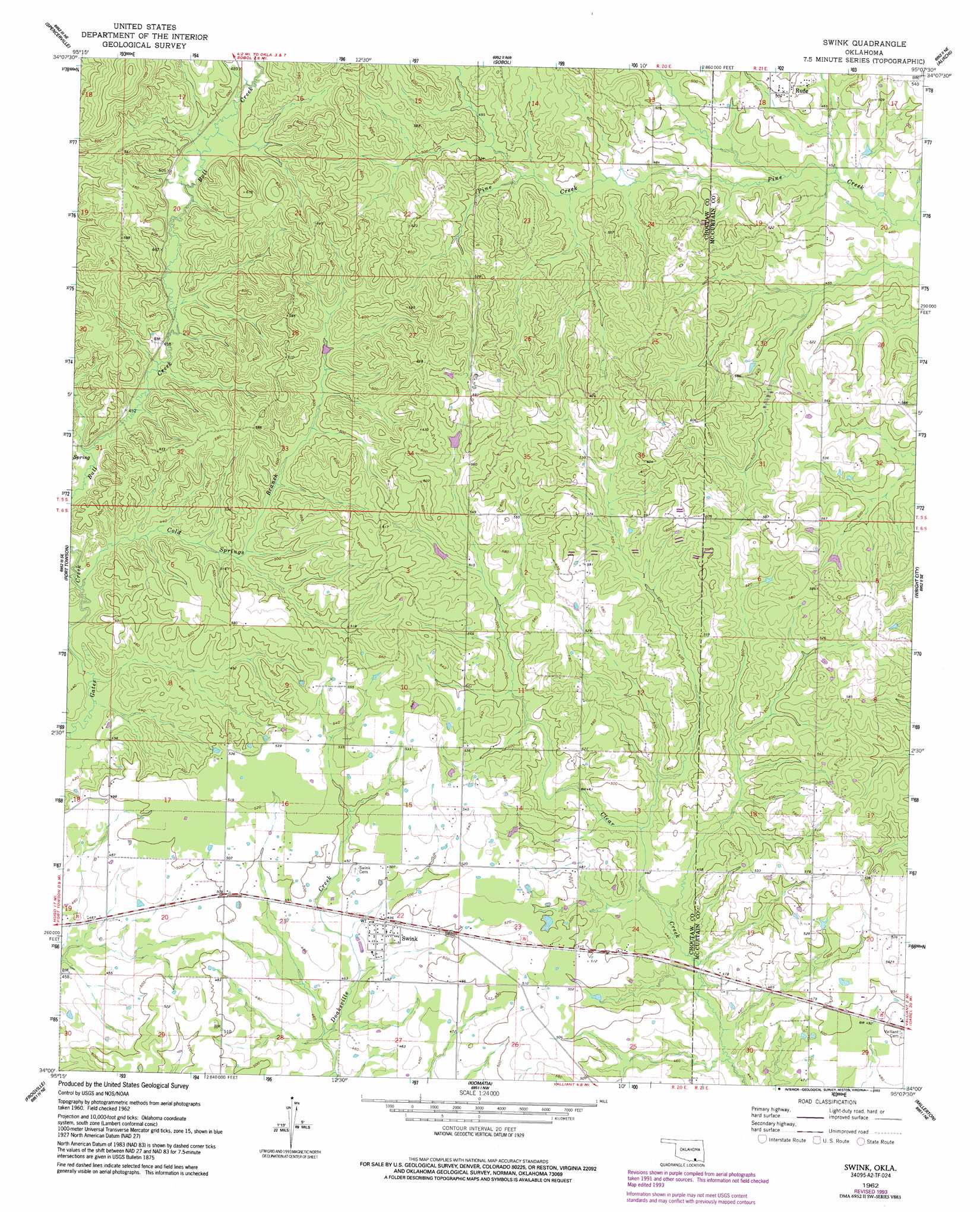
USGS Topo Quad 34095a2 - 1:24,000 scale
| Topo Map Name: | Swink |
| USGS Topo Quad ID: | 34095a2 |
| Print Size: | ca. 21 1/4" wide x 27" high |
| Southeast Coordinates: | 34° N latitude / 95.125° W longitude |
| Map Center Coordinates: | 34.0625° N latitude / 95.1875° W longitude |
| U.S. State: | OK |
| Filename: | o34095a2.jpg |
| Download Map JPG Image: | Swink topo map 1:24,000 scale |
| Map Type: | Topographic |
| Topo Series: | 7.5´ |
| Map Scale: | 1:24,000 |
| Source of Map Images: | United States Geological Survey (USGS) |
| Alternate Map Versions: |
Swink OK 1962, updated 1964 Download PDF Buy paper map Swink OK 1962, updated 1977 Download PDF Buy paper map Swink OK 1962, updated 1993 Download PDF Buy paper map Swink OK 2010 Download PDF Buy paper map Swink OK 2012 Download PDF Buy paper map Swink OK 2016 Download PDF Buy paper map |
1:24,000 Topo Quads surrounding Swink
Finley |
Cloudy |
Caney Mountain |
Signal Mountain |
Rockey Creek |
Rattan |
Spencerville |
Sobol |
Alikchi |
Bear Mountain |
Hugo Dam |
Fort Towson |
Swink |
Wright City |
Golden |
Shoals |
Frogville |
Kiomatia |
Millerton |
Garvin |
Slate Shoals |
Woodland |
Manchester |
Negley |
Acworth |
> Back to 34095a1 at 1:100,000 scale
> Back to 34094a1 at 1:250,000 scale
> Back to U.S. Topo Maps home
Swink topo map: Gazetteer
Swink: Populated Places
Rufe elevation 152m 498′Swink elevation 149m 488′
Swink: Streams
Cold Springs Branch elevation 128m 419′Tuttle Branch elevation 134m 439′
Swink digital topo map on disk
Buy this Swink topo map showing relief, roads, GPS coordinates and other geographical features, as a high-resolution digital map file on DVD: