Boswell Nw Topo Map Oklahoma
To zoom in, hover over the map of Boswell Nw
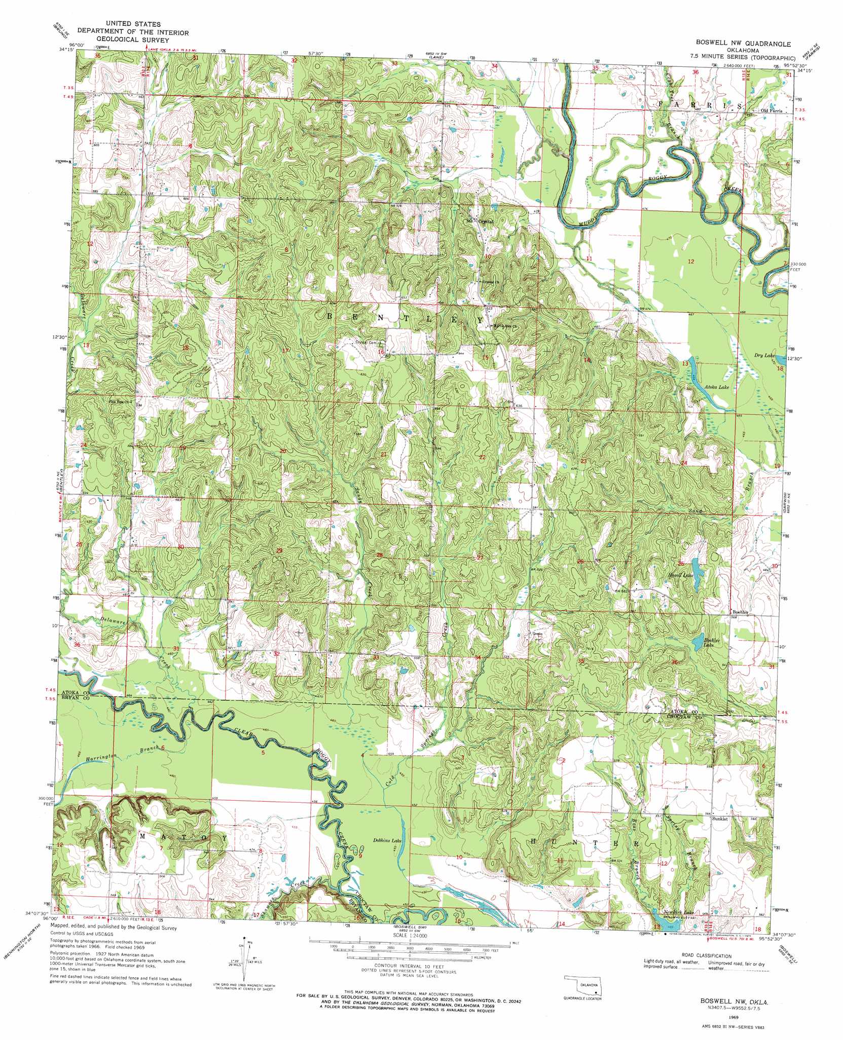
USGS Topo Quad 34095b8 - 1:24,000 scale
| Topo Map Name: | Boswell Nw |
| USGS Topo Quad ID: | 34095b8 |
| Print Size: | ca. 21 1/4" wide x 27" high |
| Southeast Coordinates: | 34.125° N latitude / 95.875° W longitude |
| Map Center Coordinates: | 34.1875° N latitude / 95.9375° W longitude |
| U.S. State: | OK |
| Filename: | o34095b8.jpg |
| Download Map JPG Image: | Boswell Nw topo map 1:24,000 scale |
| Map Type: | Topographic |
| Topo Series: | 7.5´ |
| Map Scale: | 1:24,000 |
| Source of Map Images: | United States Geological Survey (USGS) |
| Alternate Map Versions: |
Boswell NW OK 1969, updated 1971 Download PDF Buy paper map Boswell NW OK 2010 Download PDF Buy paper map Boswell NW OK 2012 Download PDF Buy paper map Boswell NW OK 2016 Download PDF Buy paper map |
1:24,000 Topo Quads surrounding Boswell Nw
Lehigh |
Stringtown |
Lane Nw |
Lane Ne |
Jumbo |
Tushka |
Bruno |
Lane |
Farris |
Moyers |
Caney |
Bentley |
Boswell Nw |
Darwin |
Antlers West |
Bokchito |
Bennington North |
Boswell Sw |
Boswell |
Soper |
Blue |
Bennington South |
Lake West |
New Oberlin |
Bluff |
> Back to 34095a1 at 1:100,000 scale
> Back to 34094a1 at 1:250,000 scale
> Back to U.S. Topo Maps home
Boswell Nw topo map: Gazetteer
Boswell Nw: Dams
Oknoname 023002 Dam elevation 162m 531′Boswell Nw: Lakes
Atoka Lake elevation 142m 465′Boehler Lake elevation 157m 515′
Dobbins Lake elevation 138m 452′
Hasell Lake elevation 154m 505′
Boswell Nw: Populated Places
Boehler elevation 173m 567′Crystal elevation 174m 570′
Old Farris elevation 156m 511′
Sunkist elevation 172m 564′
Boswell Nw: Reservoirs
Oknoname 023002 Reservoir elevation 162m 531′Boswell Nw: Streams
Crab Tree Branch elevation 137m 449′Delaware Creek elevation 137m 449′
Harrington Branch elevation 137m 449′
Sandy Creek elevation 140m 459′
Shawnee Creek elevation 137m 449′
Spring Branch elevation 149m 488′
Boswell Nw digital topo map on disk
Buy this Boswell Nw topo map showing relief, roads, GPS coordinates and other geographical features, as a high-resolution digital map file on DVD: