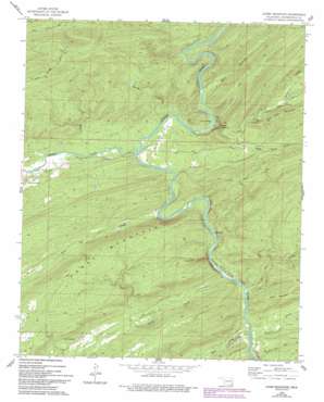
Caney Mountain Topo Map Oklahoma
To zoom in, hover over the map of Caney Mountain
USGS Topo Quad 34095c2 - 1:24,000 scale
| Topo Map Name: | Caney Mountain |
| USGS Topo Quad ID: | 34095c2 |
| Print Size: | ca. 21 1/4" wide x 27" high |
| Southeast Coordinates: | 34.25° N latitude / 95.125° W longitude |
| Map Center Coordinates: | 34.3125° N latitude / 95.1875° W longitude |
| U.S. State: | OK |
| Filename: | o34095c2.jpg |
| Download Map JPG Image: | Caney Mountain topo map 1:24,000 scale |
| Map Type: | Topographic |
| Topo Series: | 7.5´ |
| Map Scale: | 1:24,000 |
| Source of Map Images: | United States Geological Survey (USGS) |
| Alternate Map Versions: |
Caney Mountain OK 1962, updated 1964 Download PDF Buy paper map Caney Mountain OK 1962, updated 1993 Download PDF Buy paper map Caney Mountain OK 2010 Download PDF Buy paper map Caney Mountain OK 2012 Download PDF Buy paper map Caney Mountain OK 2016 Download PDF Buy paper map |
1:24,000 Topo Quads surrounding Caney Mountain
> Back to 34095a1 at 1:100,000 scale
> Back to 34094a1 at 1:250,000 scale
> Back to U.S. Topo Maps home
Caney Mountain topo map: Gazetteer
Caney Mountain: Ridges
Devils Backbone elevation 274m 898′Caney Mountain: Springs
Iron Springs elevation 173m 567′Caney Mountain: Streams
Big Branch elevation 164m 538′Can Creek elevation 139m 456′
Caney Creek elevation 142m 465′
Cloudy Creek elevation 157m 515′
Harris Creek elevation 166m 544′
Holly Creek elevation 154m 505′
Houston Creek elevation 133m 436′
North Holly Creek elevation 206m 675′
Rain Creek elevation 134m 439′
Rock Pen Creek elevation 151m 495′
South Holly Creek elevation 176m 577′
Caney Mountain: Summits
Caney Mountain elevation 320m 1049′Wolf Mountain elevation 269m 882′
Caney Mountain: Trails
Caney Creek Trail elevation 191m 626′Caney Mountain Trail elevation 285m 935′
Cloudy Nashoba Trail elevation 362m 1187′
Iron Springs Trail elevation 187m 613′
Caney Mountain: Valleys
Bear Canyon elevation 181m 593′Caney Mountain digital topo map on disk
Buy this Caney Mountain topo map showing relief, roads, GPS coordinates and other geographical features, as a high-resolution digital map file on DVD:


