Finley Topo Map Oklahoma
To zoom in, hover over the map of Finley
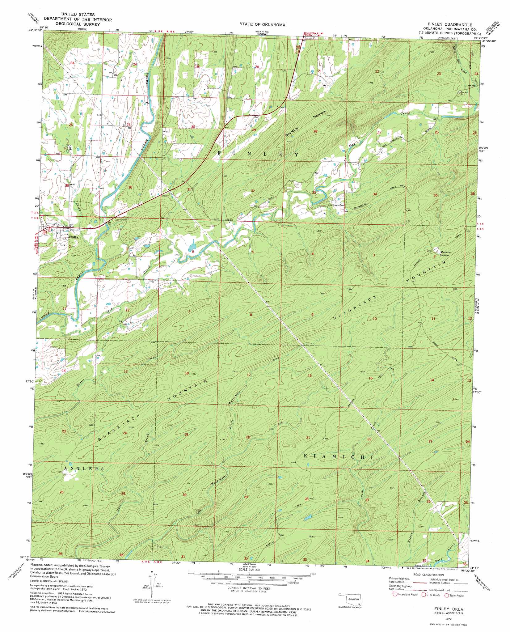
USGS Topo Quad 34095c4 - 1:24,000 scale
| Topo Map Name: | Finley |
| USGS Topo Quad ID: | 34095c4 |
| Print Size: | ca. 21 1/4" wide x 27" high |
| Southeast Coordinates: | 34.25° N latitude / 95.375° W longitude |
| Map Center Coordinates: | 34.3125° N latitude / 95.4375° W longitude |
| U.S. State: | OK |
| Filename: | o34095c4.jpg |
| Download Map JPG Image: | Finley topo map 1:24,000 scale |
| Map Type: | Topographic |
| Topo Series: | 7.5´ |
| Map Scale: | 1:24,000 |
| Source of Map Images: | United States Geological Survey (USGS) |
| Alternate Map Versions: |
Finley OK 1972, updated 1973 Download PDF Buy paper map Finley OK 2009 Download PDF Buy paper map Finley OK 2012 Download PDF Buy paper map Finley OK 2016 Download PDF Buy paper map |
1:24,000 Topo Quads surrounding Finley
Daisy |
Adel |
Stanley |
Clayton |
Albion Sw |
Jumbo |
Dunbar |
Snow |
Wildhorse Mountain |
Nashoba |
Moyers |
Kosoma |
Finley |
Cloudy |
Caney Mountain |
Antlers West |
Antlers East |
Rattan |
Spencerville |
Sobol |
Soper |
Hugo |
Hugo Dam |
Fort Towson |
Swink |
> Back to 34095a1 at 1:100,000 scale
> Back to 34094a1 at 1:250,000 scale
> Back to U.S. Topo Maps home
Finley topo map: Gazetteer
Finley: Populated Places
Finley elevation 149m 488′Finley: Springs
Medicine Springs elevation 281m 921′Finley: Streams
Dog Creek elevation 140m 459′Little Waterhole Creek elevation 181m 593′
One Creek elevation 133m 436′
Finley: Summits
Roundtop Mountain elevation 283m 928′Finley: Trails
Gunsmoke Trail elevation 237m 777′Rattan Trail elevation 287m 941′
Finley: Valleys
Tucker Hollow elevation 157m 515′Finley digital topo map on disk
Buy this Finley topo map showing relief, roads, GPS coordinates and other geographical features, as a high-resolution digital map file on DVD: