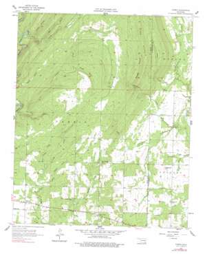
Farris Topo Map Oklahoma
To zoom in, hover over the map of Farris
USGS Topo Quad 34095c7 - 1:24,000 scale
| Topo Map Name: | Farris |
| USGS Topo Quad ID: | 34095c7 |
| Print Size: | ca. 21 1/4" wide x 27" high |
| Southeast Coordinates: | 34.25° N latitude / 95.75° W longitude |
| Map Center Coordinates: | 34.3125° N latitude / 95.8125° W longitude |
| U.S. State: | OK |
| Filename: | o34095c7.jpg |
| Download Map JPG Image: | Farris topo map 1:24,000 scale |
| Map Type: | Topographic |
| Topo Series: | 7.5´ |
| Map Scale: | 1:24,000 |
| Source of Map Images: | United States Geological Survey (USGS) |
| Alternate Map Versions: |
Farris OK 1957, updated 1958 Download PDF Buy paper map Farris OK 1957, updated 1977 Download PDF Buy paper map Farris OK 1957, updated 1991 Download PDF Buy paper map Farris OK 2010 Download PDF Buy paper map Farris OK 2013 Download PDF Buy paper map Farris OK 2016 Download PDF Buy paper map |
1:24,000 Topo Quads surrounding Farris
> Back to 34095a1 at 1:100,000 scale
> Back to 34094a1 at 1:250,000 scale
> Back to U.S. Topo Maps home
Farris topo map: Gazetteer
Farris: Dams
Oknoname 127004 Dam elevation 170m 557′Farris: Populated Places
Farris elevation 166m 544′Farris: Reservoirs
Oknoname 127004 Reservoir elevation 170m 557′Farris: Streams
Blue Creek elevation 190m 623′Clear Creek elevation 156m 511′
Colby Creek elevation 157m 515′
Crooked Creek elevation 145m 475′
Davenport Creek elevation 151m 495′
East Sandy Creek elevation 156m 511′
Little Davenport Creek elevation 152m 498′
Mill Creek elevation 157m 515′
North Branch Elm Creek elevation 152m 498′
Pine Creek elevation 152m 498′
South Branch Elm Creek elevation 152m 498′
West Sandy Creek elevation 158m 518′
Yerby Branch elevation 156m 511′
Farris: Summits
Long Mountain elevation 289m 948′Sugarloaf Hill elevation 188m 616′
Farris: Valleys
Cat Hollow elevation 145m 475′Grassy Hollow elevation 160m 524′
Prairie Hollow elevation 148m 485′
Rough Hollow elevation 190m 623′
Rough Hollow elevation 183m 600′
Farris digital topo map on disk
Buy this Farris topo map showing relief, roads, GPS coordinates and other geographical features, as a high-resolution digital map file on DVD:


