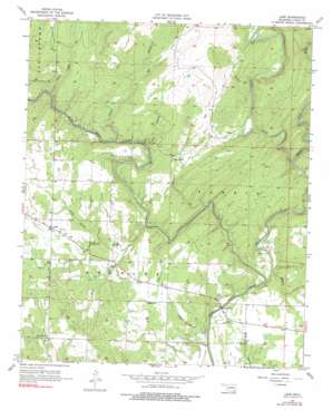
Lane Topo Map Oklahoma
To zoom in, hover over the map of Lane
USGS Topo Quad 34095c8 - 1:24,000 scale
| Topo Map Name: | Lane |
| USGS Topo Quad ID: | 34095c8 |
| Print Size: | ca. 21 1/4" wide x 27" high |
| Southeast Coordinates: | 34.25° N latitude / 95.875° W longitude |
| Map Center Coordinates: | 34.3125° N latitude / 95.9375° W longitude |
| U.S. State: | OK |
| Filename: | o34095c8.jpg |
| Download Map JPG Image: | Lane topo map 1:24,000 scale |
| Map Type: | Topographic |
| Topo Series: | 7.5´ |
| Map Scale: | 1:24,000 |
| Source of Map Images: | United States Geological Survey (USGS) |
| Alternate Map Versions: |
Lane OK 1957, updated 1958 Download PDF Buy paper map Lane OK 1957, updated 1975 Download PDF Buy paper map Lane OK 1957, updated 1991 Download PDF Buy paper map Lane OK 2010 Download PDF Buy paper map Lane OK 2013 Download PDF Buy paper map Lane OK 2016 Download PDF Buy paper map |
1:24,000 Topo Quads surrounding Lane
> Back to 34095a1 at 1:100,000 scale
> Back to 34094a1 at 1:250,000 scale
> Back to U.S. Topo Maps home
Lane topo map: Gazetteer
Lane: Populated Places
Lane elevation 177m 580′Negro Bend elevation 167m 547′
Payton Crossing elevation 140m 459′
Lane: Streams
August Creek elevation 146m 479′Cabin Creek elevation 149m 488′
Cedar Creek elevation 139m 456′
Double Springs Creek elevation 139m 456′
East Branch August Creek elevation 164m 538′
McGee Creek elevation 139m 456′
Medicine Branch elevation 140m 459′
North Branch Double Springs Creek elevation 151m 495′
Potapo Creek elevation 146m 479′
Sand Branch elevation 139m 456′
South Branch Double Springs Creek elevation 146m 479′
Wilson Creek elevation 139m 456′
Lane: Valleys
Cat Hollow elevation 146m 479′Wilson Hollow elevation 158m 518′
Lane digital topo map on disk
Buy this Lane topo map showing relief, roads, GPS coordinates and other geographical features, as a high-resolution digital map file on DVD:


