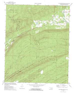
Wildhorse Mountain Topo Map Oklahoma
To zoom in, hover over the map of Wildhorse Mountain
USGS Topo Quad 34095d3 - 1:24,000 scale
| Topo Map Name: | Wildhorse Mountain |
| USGS Topo Quad ID: | 34095d3 |
| Print Size: | ca. 21 1/4" wide x 27" high |
| Southeast Coordinates: | 34.375° N latitude / 95.25° W longitude |
| Map Center Coordinates: | 34.4375° N latitude / 95.3125° W longitude |
| U.S. State: | OK |
| Filename: | o34095d3.jpg |
| Download Map JPG Image: | Wildhorse Mountain topo map 1:24,000 scale |
| Map Type: | Topographic |
| Topo Series: | 7.5´ |
| Map Scale: | 1:24,000 |
| Source of Map Images: | United States Geological Survey (USGS) |
| Alternate Map Versions: |
Wildhorse Mountain OK 1972, updated 1973 Download PDF Buy paper map Wildhorse Mountain OK 2010 Download PDF Buy paper map Wildhorse Mountain OK 2012 Download PDF Buy paper map Wildhorse Mountain OK 2016 Download PDF Buy paper map |
1:24,000 Topo Quads surrounding Wildhorse Mountain
> Back to 34095a1 at 1:100,000 scale
> Back to 34094a1 at 1:250,000 scale
> Back to U.S. Topo Maps home
Wildhorse Mountain topo map: Gazetteer
Wildhorse Mountain: Dams
Pryor Creek Site 31 Dam elevation 337m 1105′Wildhorse Mountain: Populated Places
Divide elevation 246m 807′Nashoba Y elevation 227m 744′
Wildhorse Mountain: Reservoirs
Pryor Creek Site 31 Reservoir elevation 337m 1105′Wildhorse Mountain: Springs
Sulphur Spring elevation 210m 688′Wildhorse Mountain: Streams
Buzzard Creek elevation 207m 679′Hardy Creek elevation 212m 695′
North Cedar Creek elevation 202m 662′
Slicker Creek elevation 292m 958′
Wildhorse Mountain: Summits
Blackjack Mountain elevation 379m 1243′Wildhorse Mountain elevation 385m 1263′
Wildhorse Mountain: Trails
Five N Trail elevation 397m 1302′Florence Trail elevation 364m 1194′
North One Creek Trail elevation 285m 935′
One Creek Trail elevation 325m 1066′
Six N Trail elevation 378m 1240′
Wildhorse Mountain: Valleys
Sulphur Canyon elevation 202m 662′Wildhorse Mountain digital topo map on disk
Buy this Wildhorse Mountain topo map showing relief, roads, GPS coordinates and other geographical features, as a high-resolution digital map file on DVD:


