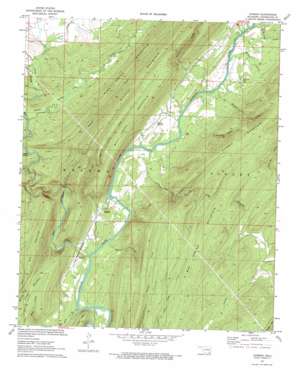
Dunbar Topo Map Oklahoma
To zoom in, hover over the map of Dunbar
USGS Topo Quad 34095d5 - 1:24,000 scale
| Topo Map Name: | Dunbar |
| USGS Topo Quad ID: | 34095d5 |
| Print Size: | ca. 21 1/4" wide x 27" high |
| Southeast Coordinates: | 34.375° N latitude / 95.5° W longitude |
| Map Center Coordinates: | 34.4375° N latitude / 95.5625° W longitude |
| U.S. State: | OK |
| Filename: | o34095d5.jpg |
| Download Map JPG Image: | Dunbar topo map 1:24,000 scale |
| Map Type: | Topographic |
| Topo Series: | 7.5´ |
| Map Scale: | 1:24,000 |
| Source of Map Images: | United States Geological Survey (USGS) |
| Alternate Map Versions: |
Dunbar OK 1972, updated 1973 Download PDF Buy paper map Dunbar OK 2010 Download PDF Buy paper map Dunbar OK 2012 Download PDF Buy paper map Dunbar OK 2016 Download PDF Buy paper map |
1:24,000 Topo Quads surrounding Dunbar
> Back to 34095a1 at 1:100,000 scale
> Back to 34094a1 at 1:250,000 scale
> Back to U.S. Topo Maps home
Dunbar topo map: Gazetteer
Dunbar: Basins
Johns Valley elevation 235m 770′Dunbar: Populated Places
Dunbar elevation 162m 531′Eubanks elevation 157m 515′
Wadena elevation 154m 505′
Dunbar: Streams
Beulah Creek elevation 148m 485′Blowup Creek elevation 146m 479′
Bull Creek elevation 146m 479′
Fobb Creek elevation 238m 780′
Hackett Creek elevation 146m 479′
Johns Creek elevation 234m 767′
Long Bell Creek elevation 146m 479′
Maddox Creek elevation 146m 479′
Marble Creek elevation 226m 741′
Monkeywrench Creek elevation 210m 688′
Mud Creek elevation 146m 479′
Pine Creek elevation 146m 479′
Stovepipe Creek elevation 172m 564′
Taylor Creek elevation 146m 479′
Wildcat Creek elevation 176m 577′
Dunbar: Summits
Big Mountain elevation 351m 1151′Box Spring Mountain elevation 325m 1066′
Bull Creek Mountain elevation 323m 1059′
Little Mountain elevation 288m 944′
Lost Mountain elevation 234m 767′
Dunbar: Trails
Wildcat Trail elevation 271m 889′Dunbar: Valleys
Blowout Hollow elevation 151m 495′Logan Hollow elevation 225m 738′
Dunbar digital topo map on disk
Buy this Dunbar topo map showing relief, roads, GPS coordinates and other geographical features, as a high-resolution digital map file on DVD:


