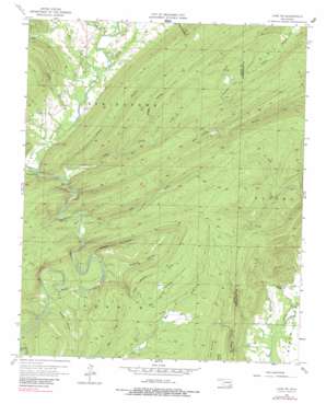
Lane Ne Topo Map Oklahoma
To zoom in, hover over the map of Lane Ne
USGS Topo Quad 34095d7 - 1:24,000 scale
| Topo Map Name: | Lane Ne |
| USGS Topo Quad ID: | 34095d7 |
| Print Size: | ca. 21 1/4" wide x 27" high |
| Southeast Coordinates: | 34.375° N latitude / 95.75° W longitude |
| Map Center Coordinates: | 34.4375° N latitude / 95.8125° W longitude |
| U.S. State: | OK |
| Filename: | o34095d7.jpg |
| Download Map JPG Image: | Lane Ne topo map 1:24,000 scale |
| Map Type: | Topographic |
| Topo Series: | 7.5´ |
| Map Scale: | 1:24,000 |
| Source of Map Images: | United States Geological Survey (USGS) |
| Alternate Map Versions: |
Lane NE OK 1957, updated 1958 Download PDF Buy paper map Lane NE OK 1957, updated 1967 Download PDF Buy paper map Lane NE OK 1957, updated 1983 Download PDF Buy paper map Lane NE OK 2010 Download PDF Buy paper map Lane NE OK 2012 Download PDF Buy paper map Lane NE OK 2016 Download PDF Buy paper map |
1:24,000 Topo Quads surrounding Lane Ne
> Back to 34095a1 at 1:100,000 scale
> Back to 34094a1 at 1:250,000 scale
> Back to U.S. Topo Maps home
Lane Ne topo map: Gazetteer
Lane Ne: Parks
Natural Scenic Recreation Area elevation 193m 633′Lane Ne: Streams
Bear Creek elevation 181m 593′Bog Spring Branch elevation 171m 561′
Grassy Branch elevation 189m 620′
Greasy Creek elevation 192m 629′
Little Bugaboo Creek elevation 239m 784′
Little Caney Creek elevation 190m 623′
Randolph Creek elevation 201m 659′
Ray Creek elevation 195m 639′
Lane Ne: Valleys
Bugaboo Canyon elevation 174m 570′Grassy Hollow elevation 164m 538′
Jacob Hollow elevation 177m 580′
Otter Hollow elevation 230m 754′
Ray Hollow elevation 200m 656′
Whisky Hollow elevation 229m 751′
Whisky Hollow elevation 209m 685′
Wildcat Canyon elevation 175m 574′
Lane Ne digital topo map on disk
Buy this Lane Ne topo map showing relief, roads, GPS coordinates and other geographical features, as a high-resolution digital map file on DVD:


