Clayton Topo Map Oklahoma
To zoom in, hover over the map of Clayton
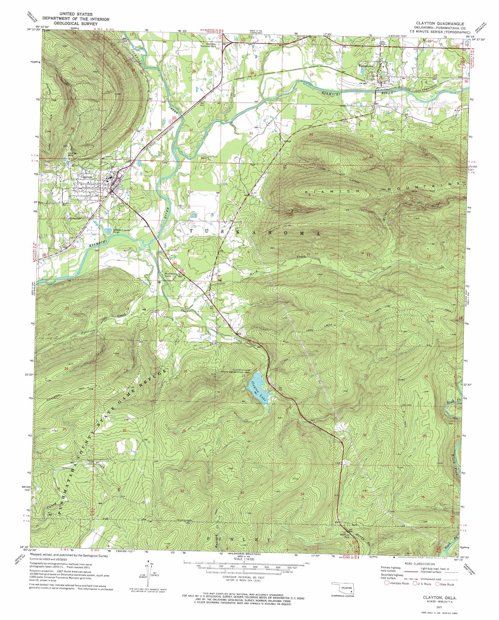
USGS Topo Quad 34095e3 - 1:24,000 scale
| Topo Map Name: | Clayton |
| USGS Topo Quad ID: | 34095e3 |
| Print Size: | ca. 21 1/4" wide x 27" high |
| Southeast Coordinates: | 34.5° N latitude / 95.25° W longitude |
| Map Center Coordinates: | 34.5625° N latitude / 95.3125° W longitude |
| U.S. State: | OK |
| Filename: | o34095e3.jpg |
| Download Map JPG Image: | Clayton topo map 1:24,000 scale |
| Map Type: | Topographic |
| Topo Series: | 7.5´ |
| Map Scale: | 1:24,000 |
| Source of Map Images: | United States Geological Survey (USGS) |
| Alternate Map Versions: |
Clayton OK 1971, updated 1973 Download PDF Buy paper map Clayton OK 2010 Download PDF Buy paper map Clayton OK 2012 Download PDF Buy paper map Clayton OK 2016 Download PDF Buy paper map |
1:24,000 Topo Quads surrounding Clayton
Hartshorne |
Higgins |
Damon |
Baker Mountain |
Talihina |
Counts |
Sardis |
Yanush |
Kiamichi |
Albion |
Adel |
Stanley |
Clayton |
Albion Sw |
Albion Se |
Dunbar |
Snow |
Wildhorse Mountain |
Nashoba |
Clebit |
Kosoma |
Finley |
Cloudy |
Caney Mountain |
Signal Mountain |
> Back to 34095e1 at 1:100,000 scale
> Back to 34094a1 at 1:250,000 scale
> Back to U.S. Topo Maps home
Clayton topo map: Gazetteer
Clayton: Dams
Clayton Dam elevation 195m 639′Clayton: Parks
Clayton Lake State Recreation Area elevation 202m 662′Stephens Memorial Park elevation 177m 580′
Clayton: Populated Places
Clayton elevation 185m 606′Tuskahoma elevation 183m 600′
Clayton: Reservoirs
Clayton Lake elevation 202m 662′Clayton: Streams
Hurd Creek elevation 170m 557′Jackfork Creek elevation 165m 541′
Peal Creek elevation 164m 538′
Peterson Creek elevation 164m 538′
Clayton: Trails
Alexander Trail elevation 327m 1072′Clayton Trail elevation 437m 1433′
Hurd Creek Trail elevation 440m 1443′
Walters Mule Trail elevation 425m 1394′
Clayton digital topo map on disk
Buy this Clayton topo map showing relief, roads, GPS coordinates and other geographical features, as a high-resolution digital map file on DVD: