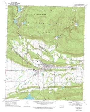
Wilburton Topo Map Oklahoma
To zoom in, hover over the map of Wilburton
USGS Topo Quad 34095h3 - 1:24,000 scale
| Topo Map Name: | Wilburton |
| USGS Topo Quad ID: | 34095h3 |
| Print Size: | ca. 21 1/4" wide x 27" high |
| Southeast Coordinates: | 34.875° N latitude / 95.25° W longitude |
| Map Center Coordinates: | 34.9375° N latitude / 95.3125° W longitude |
| U.S. State: | OK |
| Filename: | o34095h3.jpg |
| Download Map JPG Image: | Wilburton topo map 1:24,000 scale |
| Map Type: | Topographic |
| Topo Series: | 7.5´ |
| Map Scale: | 1:24,000 |
| Source of Map Images: | United States Geological Survey (USGS) |
| Alternate Map Versions: |
Wilburton OK 1971, updated 1973 Download PDF Buy paper map Wilburton OK 2010 Download PDF Buy paper map Wilburton OK 2013 Download PDF Buy paper map Wilburton OK 2016 Download PDF Buy paper map |
1:24,000 Topo Quads surrounding Wilburton
> Back to 34095e1 at 1:100,000 scale
> Back to 34094a1 at 1:250,000 scale
> Back to U.S. Topo Maps home
Wilburton topo map: Gazetteer
Wilburton: Airports
Austin Airport elevation 206m 675′Wilburton: Dams
Carlton Dam elevation 218m 715′Fourche Maline Creek Site 2 Dam elevation 209m 685′
Fourche Maline Creek Site 3 Dam elevation 277m 908′
Fourche Maline Creek Site 4 Dam elevation 224m 734′
Fourche Maline Creek Site 5 Dam elevation 245m 803′
Fourche Maline Creek Site 7 Dam elevation 231m 757′
Fourche Maline Creek Site 8 Dam elevation 201m 659′
Oknoname 077004 Dam elevation 197m 646′
Oknoname 077005 Dam elevation 266m 872′
Wilburton: Lakes
Lake Carlton elevation 215m 705′Wilburton: Populated Places
Center Point elevation 196m 643′Degnan elevation 202m 662′
Lutie elevation 182m 597′
Wilburton elevation 201m 659′
Wilburton: Reservoirs
Fourche Maline Creek Site 2 Reservoir elevation 209m 685′Fourche Maline Creek Site 3 Reservoir elevation 277m 908′
Fourche Maline Creek Site 4 Reservoir elevation 224m 734′
Fourche Maline Creek Site 5 Reservoir elevation 245m 803′
Fourche Maline Creek Site 7 Reservoir elevation 231m 757′
Fourche Maline Creek Site 8 Reservoir elevation 201m 659′
Lake Carlton elevation 218m 715′
Lake Wayne Wallace elevation 241m 790′
Lloyd Church Lake elevation 228m 748′
Oknoname 077004 Reservoir elevation 197m 646′
Oknoname 077005 Reservoir elevation 266m 872′
Wilburton: Streams
Coon Creek elevation 206m 675′Cunneo Tubby Creek elevation 183m 600′
Wilburton digital topo map on disk
Buy this Wilburton topo map showing relief, roads, GPS coordinates and other geographical features, as a high-resolution digital map file on DVD:


