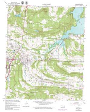
Krebs Topo Map Oklahoma
To zoom in, hover over the map of Krebs
USGS Topo Quad 34095h6 - 1:24,000 scale
| Topo Map Name: | Krebs |
| USGS Topo Quad ID: | 34095h6 |
| Print Size: | ca. 21 1/4" wide x 27" high |
| Southeast Coordinates: | 34.875° N latitude / 95.625° W longitude |
| Map Center Coordinates: | 34.9375° N latitude / 95.6875° W longitude |
| U.S. State: | OK |
| Filename: | o34095h6.jpg |
| Download Map JPG Image: | Krebs topo map 1:24,000 scale |
| Map Type: | Topographic |
| Topo Series: | 7.5´ |
| Map Scale: | 1:24,000 |
| Source of Map Images: | United States Geological Survey (USGS) |
| Alternate Map Versions: |
Krebs OK 1967, updated 1968 Download PDF Buy paper map Krebs OK 1967, updated 1978 Download PDF Buy paper map Krebs OK 2010 Download PDF Buy paper map Krebs OK 2012 Download PDF Buy paper map Krebs OK 2016 Download PDF Buy paper map |
1:24,000 Topo Quads surrounding Krebs
> Back to 34095e1 at 1:100,000 scale
> Back to 34094a1 at 1:250,000 scale
> Back to U.S. Topo Maps home
Krebs topo map: Gazetteer
Krebs: Airports
McAlester Regional Hospital Heliport elevation 214m 702′Krebs: Dams
Fin Feather Lake Dam elevation 204m 669′Oknoname 121012 Dam elevation 189m 620′
Oknoname 121013 Dam elevation 203m 666′
Smithson Lake Dam elevation 213m 698′
Krebs: Lakes
Fin and Feather Lake elevation 203m 666′Krebs: Parks
Highway 31 Landing Recreation Area elevation 186m 610′Krebs: Populated Places
Alderson elevation 210m 688′Bache elevation 236m 774′
Carbon elevation 205m 672′
Krebs elevation 200m 656′
Richville elevation 192m 629′
Krebs: Reservoirs
Fin Feather Lake elevation 204m 669′Krebs Lake elevation 231m 757′
Oknoname 121012 Reservoir elevation 189m 620′
Oknoname 121013 Reservoir elevation 203m 666′
Smithson Lake elevation 211m 692′
Krebs: Streams
Buck Creek elevation 180m 590′Mud Creek elevation 178m 583′
Krebs: Summits
Bald Knob elevation 241m 790′Buck Hill elevation 232m 761′
Pine Knob elevation 291m 954′
Krebs digital topo map on disk
Buy this Krebs topo map showing relief, roads, GPS coordinates and other geographical features, as a high-resolution digital map file on DVD:


