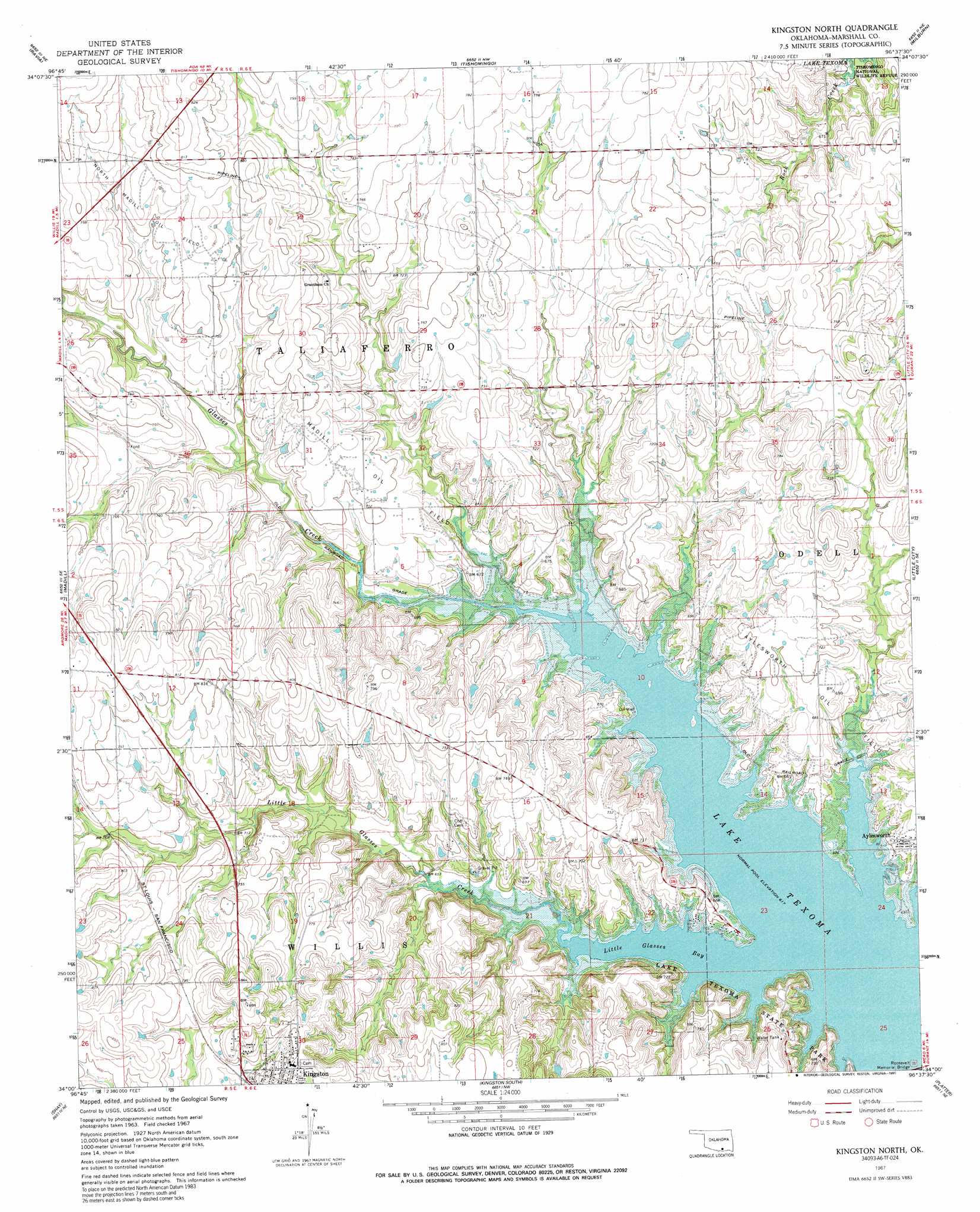
Kingston North Topo Map Oklahoma
To zoom in, hover over the map of Kingston North
USGS Topo Quad 34096a6 - 1:24,000 scale
| Topo Map Name: | Kingston North |
| USGS Topo Quad ID: | 34096a6 |
| Print Size: | ca. 21 1/4" wide x 27" high |
| Southeast Coordinates: | 34° N latitude / 96.625° W longitude |
| Map Center Coordinates: | 34.0625° N latitude / 96.6875° W longitude |
| U.S. State: | OK |
| Filename: | o34096a6.jpg |
| Download Map JPG Image: | Kingston North topo map 1:24,000 scale |
| Map Type: | Topographic |
| Topo Series: | 7.5´ |
| Map Scale: | 1:24,000 |
| Source of Map Images: | United States Geological Survey (USGS) |
| Alternate Map Versions: |
Tishomingo SW OK 1967, updated 1968 Download PDF Buy paper map Kingston North OK 1967, updated 1991 Download PDF Buy paper map Kingston North OK 2010 Download PDF Buy paper map Kingston North OK 2013 Download PDF Buy paper map Kingston North OK 2016 Download PDF Buy paper map |
1:24,000 Topo Quads surrounding Kingston North
Nebo |
Troy |
Reagan |
Connerville Se |
Wapanucka South |
Mannsville |
Ravia |
Kingston North |
Milburn |
Caddo Nw |
Mcmillan |
Madill |
Kingston North |
Little City |
Durant North |
Lebanon |
Shay |
Kingston South |
Platter |
Durant South |
Dexter |
Gordonville |
Pottsboro |
Denison Dam |
Achille |
> Back to 34096a1 at 1:100,000 scale
> Back to 34096a1 at 1:250,000 scale
> Back to U.S. Topo Maps home
Kingston North topo map: Gazetteer
Kingston North: Bays
Little Glasses Bay elevation 188m 616′Kingston North: Bridges
Roosevelt Memorial Bridge elevation 188m 616′Kingston North: Dams
Cushing Country Club Dam elevation 242m 793′Kingston North: Oilfields
Aylesworth Oil Field elevation 198m 649′Madill Oil Field elevation 216m 708′
North Madill Oil Field elevation 237m 777′
Kingston North: Populated Places
Aylesworth elevation 204m 669′Kingston North: Reservoirs
Cushing Country Club Reservoir elevation 242m 793′Kingston North: Streams
Glasses Creek elevation 188m 616′Little Glasses Creek elevation 188m 616′
Kingston North digital topo map on disk
Buy this Kingston North topo map showing relief, roads, GPS coordinates and other geographical features, as a high-resolution digital map file on DVD: