Mcmillan Topo Map Oklahoma
To zoom in, hover over the map of Mcmillan
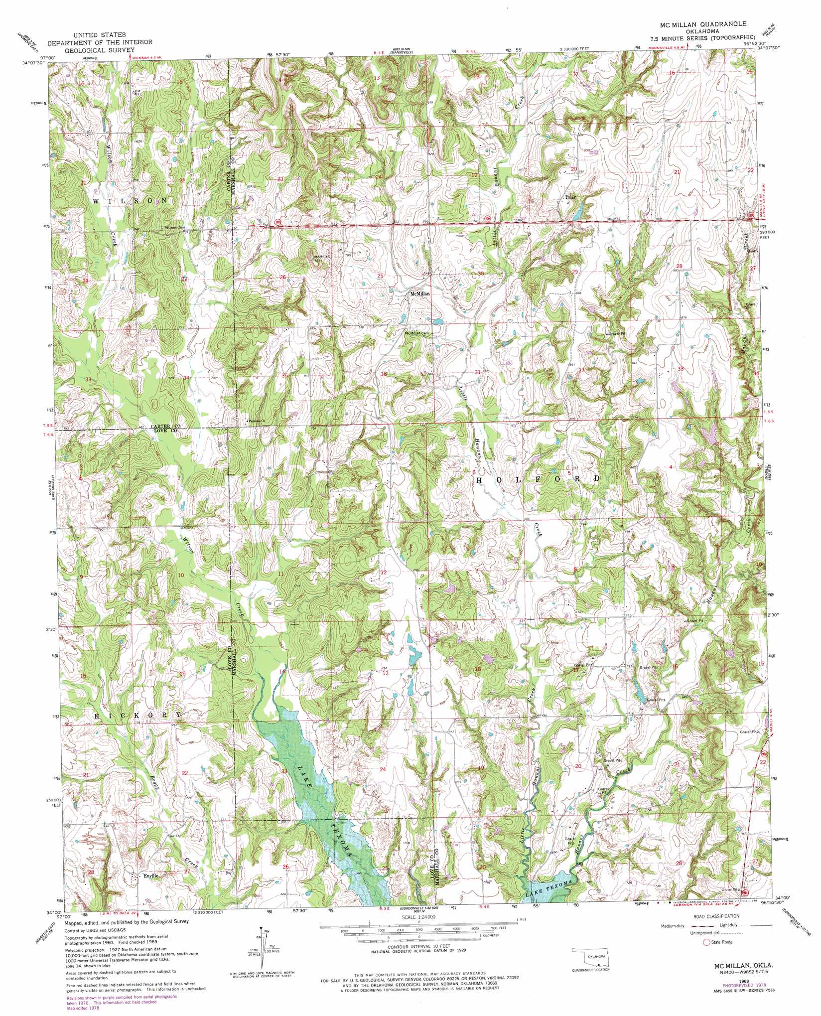
USGS Topo Quad 34096a8 - 1:24,000 scale
| Topo Map Name: | Mcmillan |
| USGS Topo Quad ID: | 34096a8 |
| Print Size: | ca. 21 1/4" wide x 27" high |
| Southeast Coordinates: | 34° N latitude / 96.875° W longitude |
| Map Center Coordinates: | 34.0625° N latitude / 96.9375° W longitude |
| U.S. State: | OK |
| Filename: | o34096a8.jpg |
| Download Map JPG Image: | Mcmillan topo map 1:24,000 scale |
| Map Type: | Topographic |
| Topo Series: | 7.5´ |
| Map Scale: | 1:24,000 |
| Source of Map Images: | United States Geological Survey (USGS) |
| Alternate Map Versions: |
Mc Millan OK 1963, updated 1964 Download PDF Buy paper map Mc Millan OK 1963, updated 1978 Download PDF Buy paper map McMillan OK 2009 Download PDF Buy paper map McMillan OK 2013 Download PDF Buy paper map McMillan OK 2016 Download PDF Buy paper map |
1:24,000 Topo Quads surrounding Mcmillan
Springer |
Gene Autry |
Nebo |
Troy |
Reagan |
Ardmore West |
Ardmore East |
Mannsville |
Ravia |
Kingston North |
Overbrook |
Lake Murray |
Mcmillan |
Madill |
Kingston North |
Marietta West |
Marietta East |
Lebanon |
Shay |
Kingston South |
Thackerville |
Horseshoe Bend |
Dexter |
Gordonville |
Pottsboro |
> Back to 34096a1 at 1:100,000 scale
> Back to 34096a1 at 1:250,000 scale
> Back to U.S. Topo Maps home
Mcmillan topo map: Gazetteer
Mcmillan: Dams
Jack McDearman 8 Dam elevation 220m 721′Jim Conrad Dam elevation 218m 715′
Milford Clement Dam elevation 248m 813′
Oknoname 095001 Dam elevation 210m 688′
Mcmillan: Populated Places
Eville elevation 228m 748′McMillan elevation 231m 757′
Tyler elevation 270m 885′
Mcmillan: Reservoirs
Jack McDearman Reservoir elevation 220m 721′Jim Conrad Reservoir elevation 218m 715′
Milford Clement Reservoir elevation 248m 813′
Oknoname 095001 Reservoir elevation 210m 688′
Mcmillan: Streams
Hauani Creek elevation 213m 698′Mcmillan digital topo map on disk
Buy this Mcmillan topo map showing relief, roads, GPS coordinates and other geographical features, as a high-resolution digital map file on DVD: