Bentley Topo Map Oklahoma
To zoom in, hover over the map of Bentley
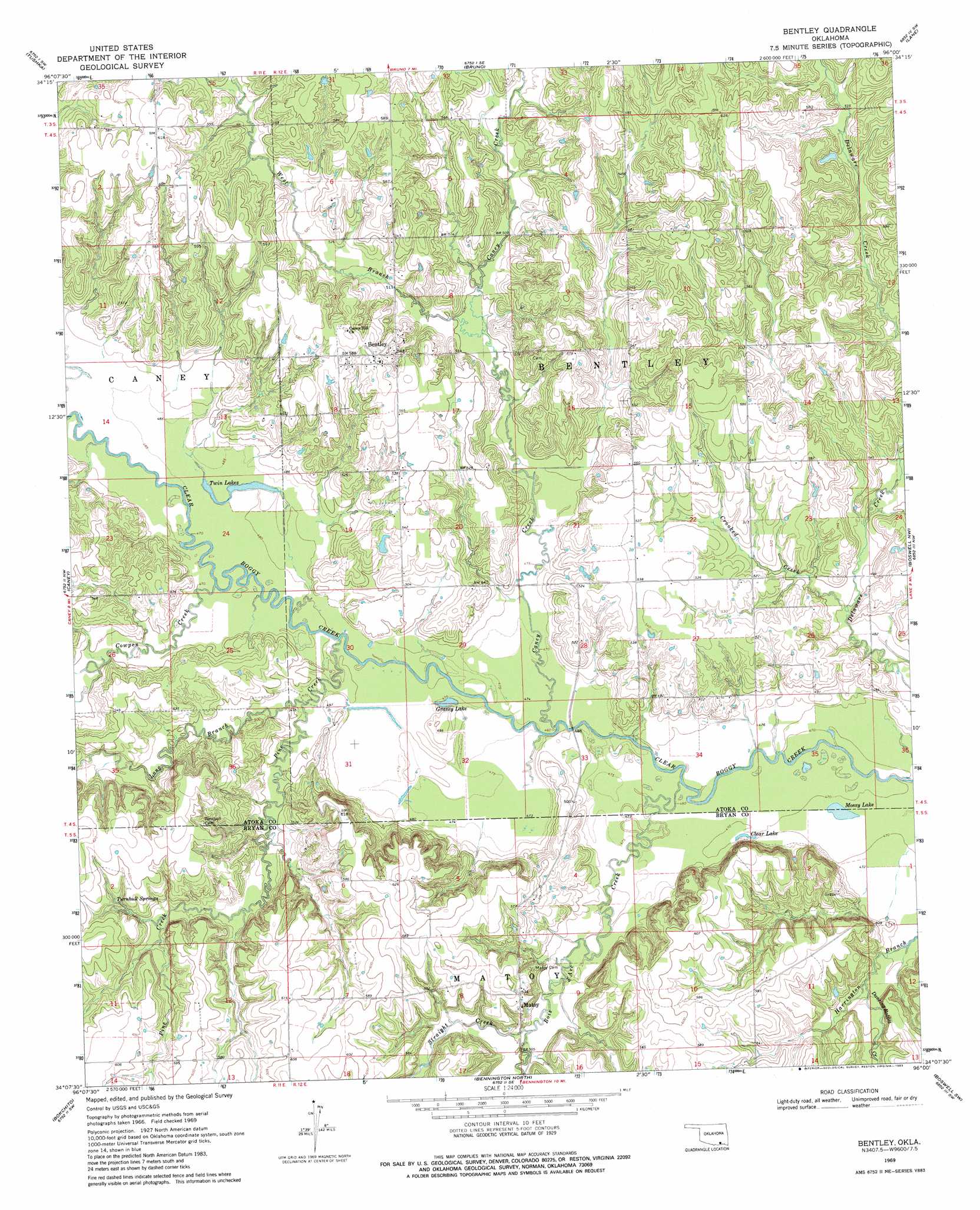
USGS Topo Quad 34096b1 - 1:24,000 scale
| Topo Map Name: | Bentley |
| USGS Topo Quad ID: | 34096b1 |
| Print Size: | ca. 21 1/4" wide x 27" high |
| Southeast Coordinates: | 34.125° N latitude / 96° W longitude |
| Map Center Coordinates: | 34.1875° N latitude / 96.0625° W longitude |
| U.S. State: | OK |
| Filename: | o34096b1.jpg |
| Download Map JPG Image: | Bentley topo map 1:24,000 scale |
| Map Type: | Topographic |
| Topo Series: | 7.5´ |
| Map Scale: | 1:24,000 |
| Source of Map Images: | United States Geological Survey (USGS) |
| Alternate Map Versions: |
Bentley OK 1969, updated 1971 Download PDF Buy paper map Bentley OK 1969, updated 1983 Download PDF Buy paper map Bentley OK 2009 Download PDF Buy paper map Bentley OK 2012 Download PDF Buy paper map Bentley OK 2016 Download PDF Buy paper map |
1:24,000 Topo Quads surrounding Bentley
Olney |
Lehigh |
Stringtown |
Lane Nw |
Lane Ne |
Boggy Depot |
Tushka |
Bruno |
Lane |
Farris |
Caddo North |
Caney |
Bentley |
Boswell Nw |
Darwin |
Caddo South |
Bokchito |
Bennington North |
Boswell Sw |
Boswell |
Roberta |
Blue |
Bennington South |
Lake West |
New Oberlin |
> Back to 34096a1 at 1:100,000 scale
> Back to 34096a1 at 1:250,000 scale
> Back to U.S. Topo Maps home
Bentley topo map: Gazetteer
Bentley: Airports
Canyon Springs Ranch Airport elevation 187m 613′Bentley: Lakes
Clear Lake elevation 143m 469′Grassy Lake elevation 142m 465′
Mossy Lake elevation 142m 465′
Twin Lakes elevation 145m 475′
Bentley: Populated Places
Bentley elevation 177m 580′Matoy elevation 175m 574′
Bentley: Springs
Turnbull Springs elevation 172m 564′Bentley: Streams
Bois d'Arc Creek elevation 140m 459′Caney Creek elevation 142m 465′
Cowpen Creek elevation 143m 469′
Crooked Creek elevation 147m 482′
Dancing Rabbit Creek elevation 146m 479′
Long Branch elevation 144m 472′
Pine Creek elevation 143m 469′
Straight Creek elevation 149m 488′
West Branch Caney Creek elevation 151m 495′
Bentley digital topo map on disk
Buy this Bentley topo map showing relief, roads, GPS coordinates and other geographical features, as a high-resolution digital map file on DVD: