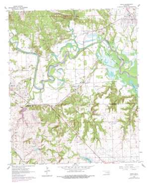
Ravia Topo Map Oklahoma
To zoom in, hover over the map of Ravia
USGS Topo Quad 34096b7 - 1:24,000 scale
| Topo Map Name: | Ravia |
| USGS Topo Quad ID: | 34096b7 |
| Print Size: | ca. 21 1/4" wide x 27" high |
| Southeast Coordinates: | 34.125° N latitude / 96.75° W longitude |
| Map Center Coordinates: | 34.1875° N latitude / 96.8125° W longitude |
| U.S. State: | OK |
| Filename: | o34096b7.jpg |
| Download Map JPG Image: | Ravia topo map 1:24,000 scale |
| Map Type: | Topographic |
| Topo Series: | 7.5´ |
| Map Scale: | 1:24,000 |
| Source of Map Images: | United States Geological Survey (USGS) |
| Alternate Map Versions: |
Ravia OK 1963, updated 1964 Download PDF Buy paper map Ravia OK 1963, updated 1978 Download PDF Buy paper map Ravia OK 2009 Download PDF Buy paper map Ravia OK 2013 Download PDF Buy paper map Ravia OK 2016 Download PDF Buy paper map |
1:24,000 Topo Quads surrounding Ravia
> Back to 34096a1 at 1:100,000 scale
> Back to 34096a1 at 1:250,000 scale
> Back to U.S. Topo Maps home
Ravia topo map: Gazetteer
Ravia: Airports
Madill Municipal Airport elevation 266m 872′Ravia: Dams
John O'Banion 10 Dam elevation 268m 879′Lake Oteka Dam elevation 208m 682′
Oknoname 095004 Dam elevation 230m 754′
W M Chapman Dam elevation 210m 688′
Ravia: Lakes
Randolph Lake elevation 195m 639′Ravia: Populated Places
Ravia elevation 233m 764′Russett elevation 206m 675′
Ravia: Reservoirs
John O'Banion 10 Reservoir elevation 268m 879′Lake Oteka elevation 208m 682′
Oknoname 095004 Reservoir elevation 230m 754′
W M Chapman Reservoir elevation 210m 688′
Ravia: Streams
Camp Creek elevation 195m 639′Cedar Creek elevation 209m 685′
Courtney Creek elevation 195m 639′
Mill Creek elevation 195m 639′
Oil Creek elevation 194m 636′
Sycamore Creek elevation 198m 649′
Turkey Creek elevation 195m 639′
Ravia digital topo map on disk
Buy this Ravia topo map showing relief, roads, GPS coordinates and other geographical features, as a high-resolution digital map file on DVD:


