Stringtown Topo Map Oklahoma
To zoom in, hover over the map of Stringtown
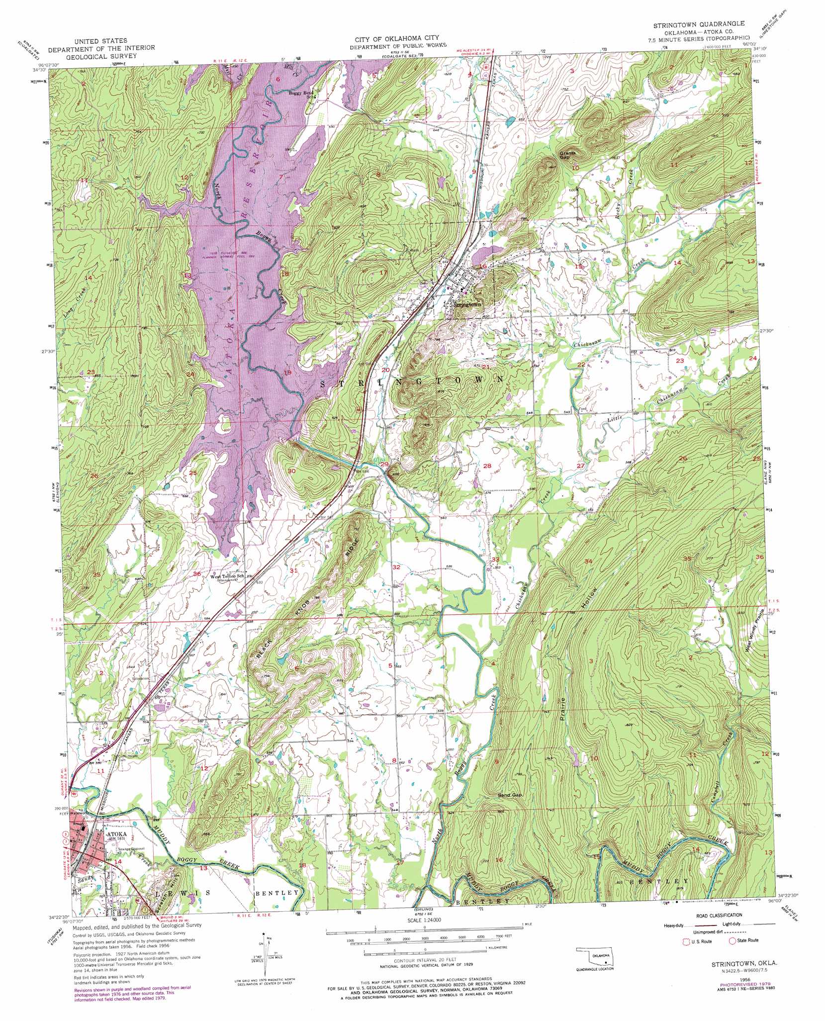
USGS Topo Quad 34096d1 - 1:24,000 scale
| Topo Map Name: | Stringtown |
| USGS Topo Quad ID: | 34096d1 |
| Print Size: | ca. 21 1/4" wide x 27" high |
| Southeast Coordinates: | 34.375° N latitude / 96° W longitude |
| Map Center Coordinates: | 34.4375° N latitude / 96.0625° W longitude |
| U.S. State: | OK |
| Filename: | o34096d1.jpg |
| Download Map JPG Image: | Stringtown topo map 1:24,000 scale |
| Map Type: | Topographic |
| Topo Series: | 7.5´ |
| Map Scale: | 1:24,000 |
| Source of Map Images: | United States Geological Survey (USGS) |
| Alternate Map Versions: |
Stringtown OK 1956, updated 1958 Download PDF Buy paper map Stringtown OK 1956, updated 1979 Download PDF Buy paper map Stringtown OK 2010 Download PDF Buy paper map Stringtown OK 2012 Download PDF Buy paper map Stringtown OK 2016 Download PDF Buy paper map |
1:24,000 Topo Quads surrounding Stringtown
Tupelo Ne |
Parker |
Wardville |
Kiowa |
Pittsburg |
Centrahoma |
Coalgate |
Coalgate Se |
Limestone Gap |
Redden |
Olney |
Lehigh |
Stringtown |
Lane Nw |
Lane Ne |
Boggy Depot |
Tushka |
Bruno |
Lane |
Farris |
Caddo North |
Caney |
Bentley |
Boswell Nw |
Darwin |
> Back to 34096a1 at 1:100,000 scale
> Back to 34096a1 at 1:250,000 scale
> Back to U.S. Topo Maps home
Stringtown topo map: Gazetteer
Stringtown: Dams
Atoka Reservoir Dam elevation 194m 636′Stringtown: Flats
West Windy Prairie elevation 235m 770′Stringtown: Gaps
Grants Gap elevation 192m 629′Sand Gap elevation 168m 551′
Stringtown: Populated Places
Stringtown elevation 191m 626′Stringtown: Reservoirs
Atoka Reservoir elevation 194m 636′Katy Lake elevation 165m 541′
Stringtown: Ridges
Black Knob Ridge elevation 240m 787′Stringtown: Streams
Camel Creek elevation 171m 561′Campbell Creek elevation 152m 498′
Chickasaw Creek elevation 155m 508′
Little Chickasaw Creek elevation 165m 541′
Mill Creek elevation 180m 590′
North Boggy Creek elevation 152m 498′
Rocky Creek elevation 171m 561′
Sandy Creek elevation 159m 521′
Stringtown: Valleys
Prairie Hollow elevation 164m 538′Stringtown digital topo map on disk
Buy this Stringtown topo map showing relief, roads, GPS coordinates and other geographical features, as a high-resolution digital map file on DVD: